Sold

Floyd County, IA
80.00 Acres M/L

Floyd Line Street / Addison Avenue
Nashua, IA 50653

Price $880,000
Listing #15484

LAND AGENT

Chase Duesenberg

Office: 515.222.1347
Mobile: 641.529.0562
Chase@PeoplesCompany.com

Property Info

Description

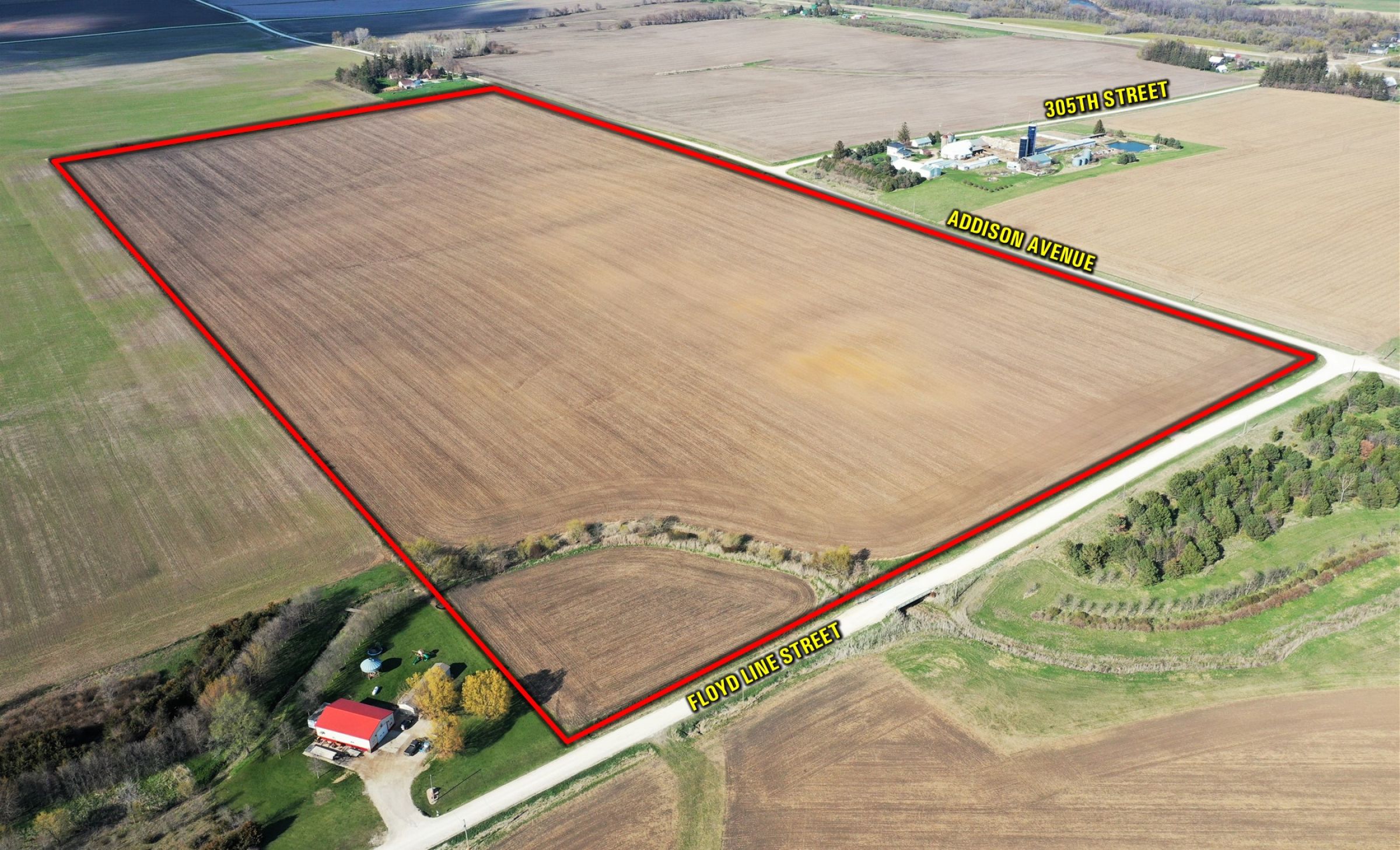
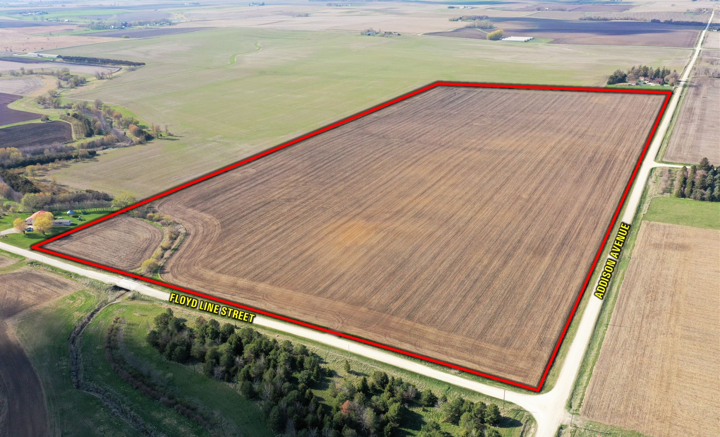
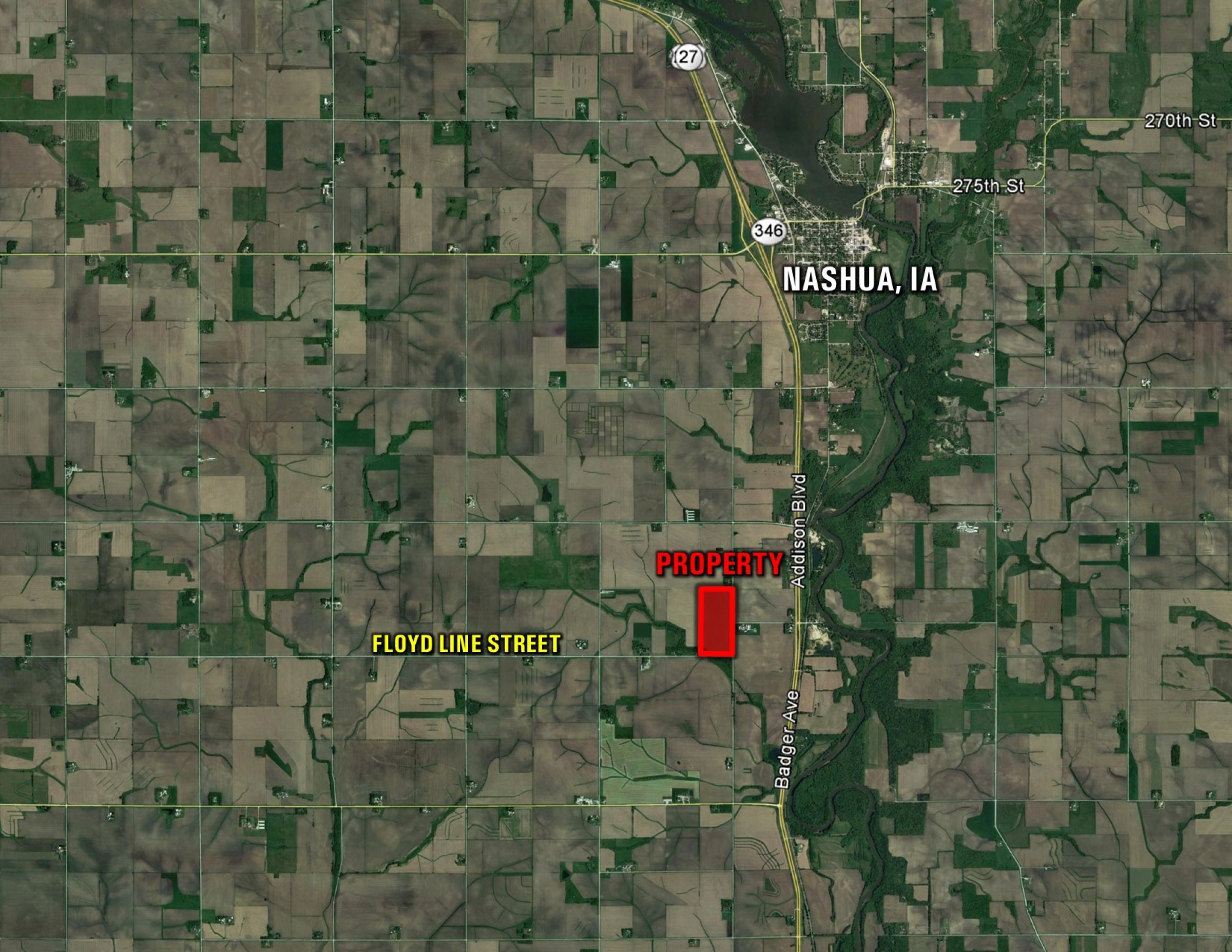
Farmland available in southeast Floyd County, Iowa! Peoples Company is representing the sale of 80 gross acres m/l located southwest of Nashua, Iowa. The farmland consists of 75.8 NHEL FSA tillable acres carrying a CSR2 of 81.3. High-quality soil types include Ostrander & Floyd loam. There are several competing grain marketing options located nearby and great access to the surrounding area with close proximity to US Highway 218. Private tile has been installed on the farm (See Attached Tile Map).

The farm is leased for the 2021 crop year, but farming rights will be open for the 2022 growing season (Contact Agent for details). This land would be a great add-on to an existing farming operation or a smart investment for the Buyer looking to diversify their portfolio. The property is located in Section 36 of Riverton Township.

Legal Description

The East Half of the Southeast Quarter (E1/2 SE1/4) of Section 36, Township 94 North, Range 15 West of the 5th P.M., Floyd County, Iowa. Exact legal description to be taken from the Abstract.

Details

FSA Cropland Acres: 75.8
Corn: 38.3 base acres with a PLC Yield of 167
Soybeans: 33 base acres with a PLC Yield of 49

Directions

From Nashua, Iowa: Travel west out of Nashua on Sample Street merging onto US Highway 218 South for 1.8 miles until reaching 300th Street. Turn right (west) on 300th Street for a half-mile until reaching Addison Avenue. Turn left (south) on Addison Avenue for a half-mile and the property will be situated on the west side of Addison Avenue marked with a Peoples Company sign.

  • Sign On Property: Yes
  • MLS Number: 627749
  • Parcel Number: 16-36-400-002-00
  • School District: Nashua-Plainfield Community School District
  • General Area: Southwest of Nashua, Iowa
  • Net Taxes: $2,076.00
  • CSR2: 81.30
  • Zoning: Ag


Interactive Map

Use the Interactive Map to explore the property's regional location. Zoom in and out to see the property's surroundings and toggle various mapping layers on and off in the Map Layer Menu.


Photos

Listing Photo Listing Photo Listing Photo Listing Photo Listing Photo Listing Photo Listing Photo Listing Photo Listing Photo