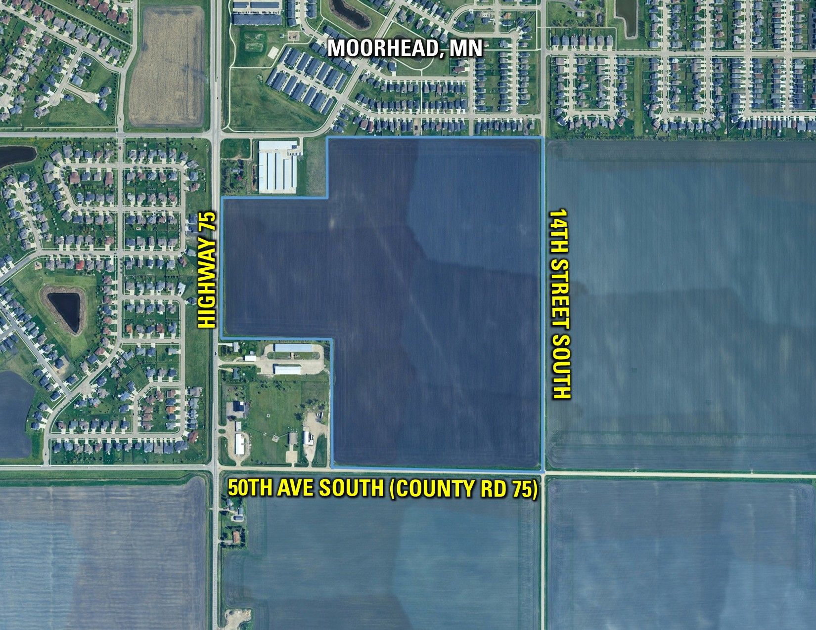
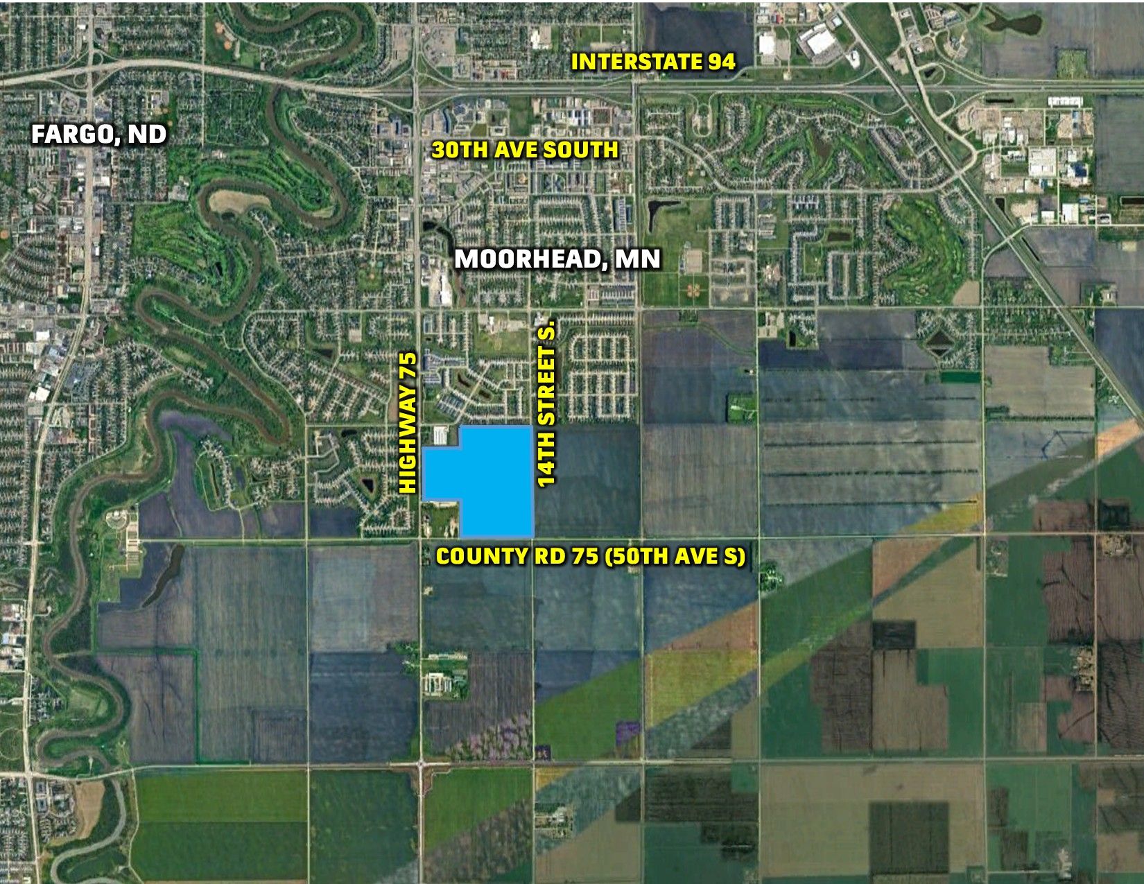
Prime Development Land, South Moorhead, Clay County, MN
Clay County, MN
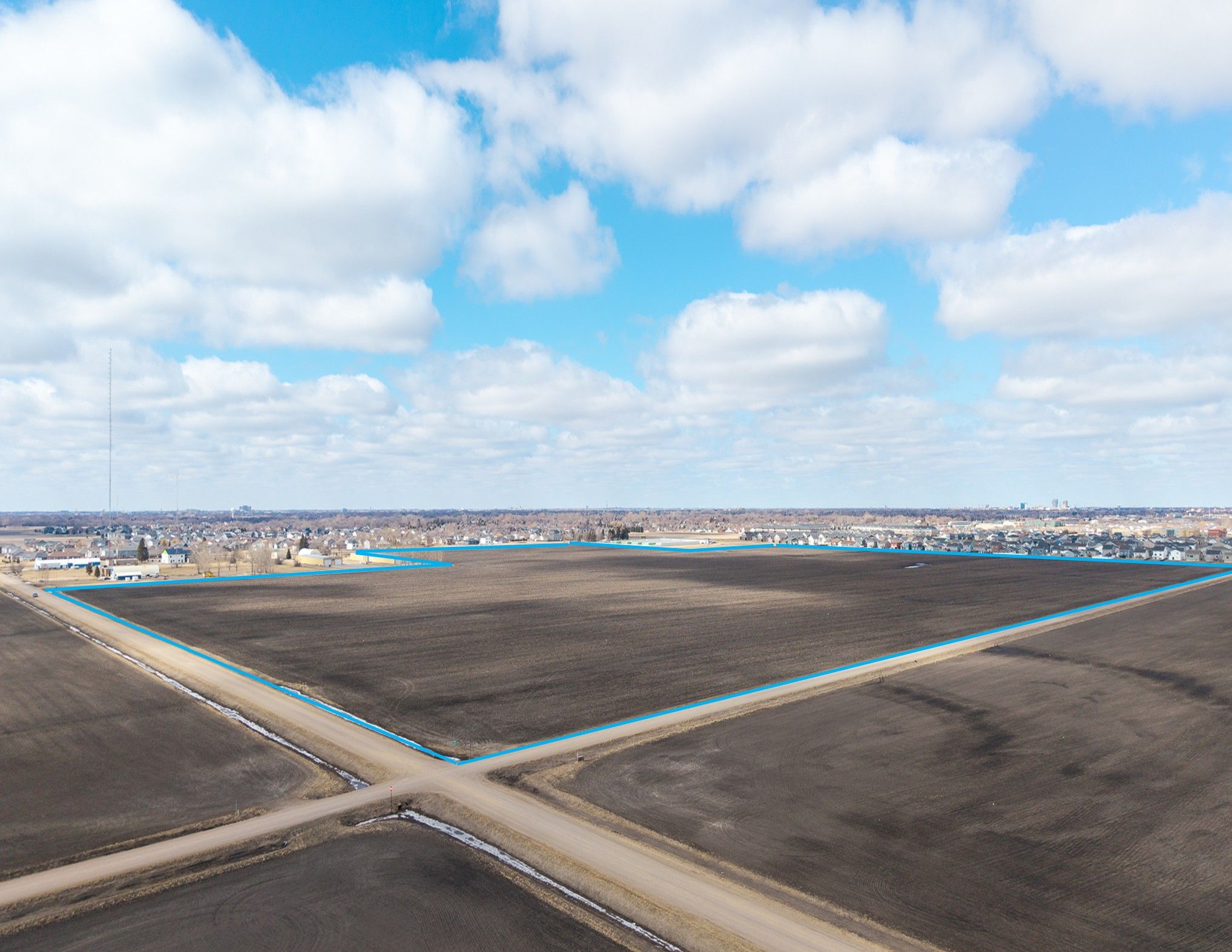
127.27 Acres M/L
127.27 Acres M/L
Highway 75 & County Road 75
Moorhead, MN 56560
| Price | $2,290,000 |
| Listing | #19271 |

Property Info
Description
Legal Description
Directions
About The Tenant
- Sign On Property: Yes
- Parcel Number: 21.029.4000, 21.062.0101, 21.062.0201, 21.062.0301 & 21.062.9999
- School District: Moorhead Area Public Schools
- General Area: Moorhead, MN
- Net Taxes: $5,972.00
- Soil Productivity: 90.5
- Zoning: Ag Non-Homestead & Ag-Homestead
Interactive Map
Use the Interactive Map to explore the property's regional location. Zoom in and out to see the property's surroundings and toggle various mapping layers on and off in the Map Layer Menu.
Photos
.jpg)
.jpg)
.jpg)
.jpg)
.jpg)
.jpg)