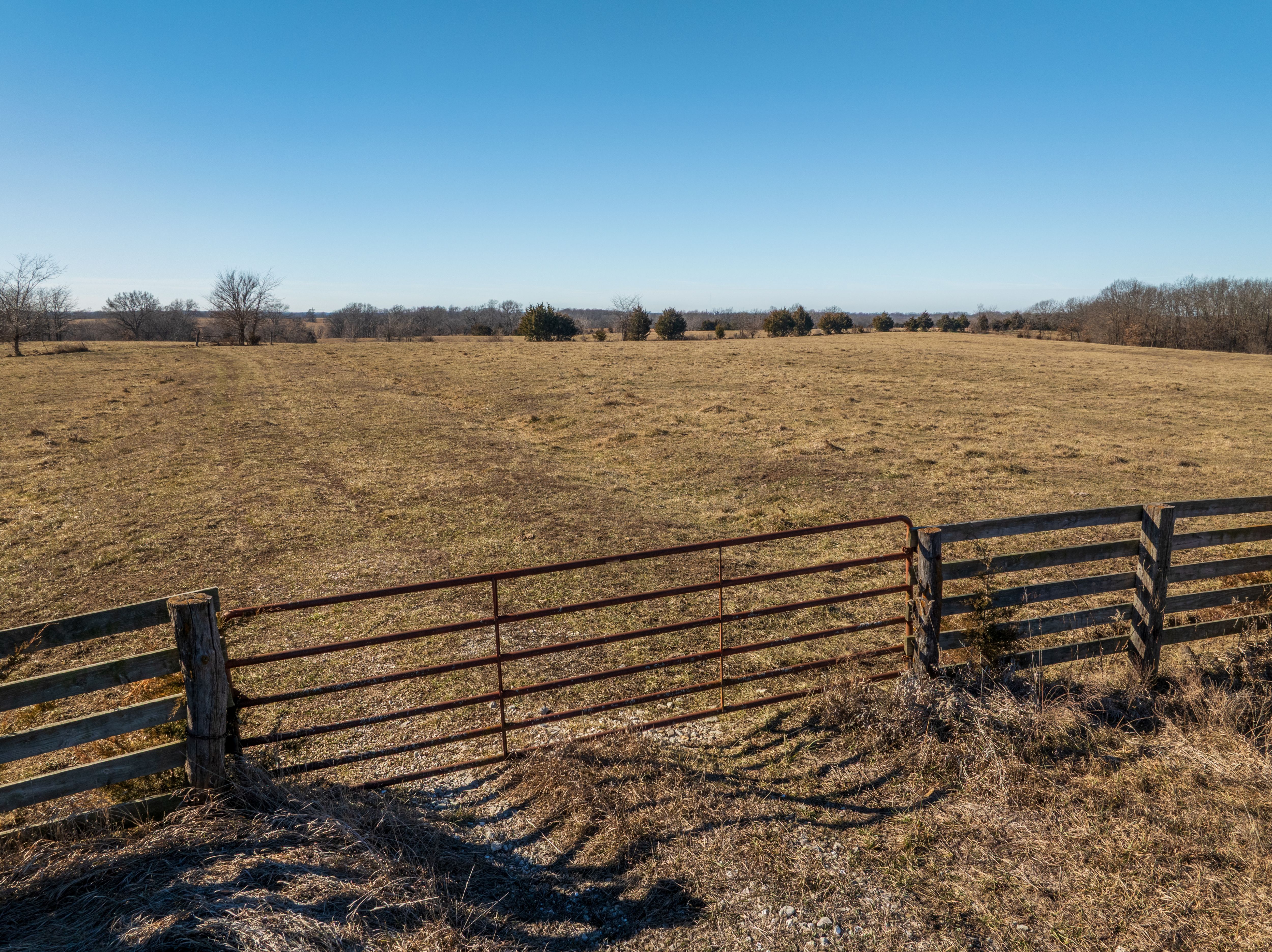
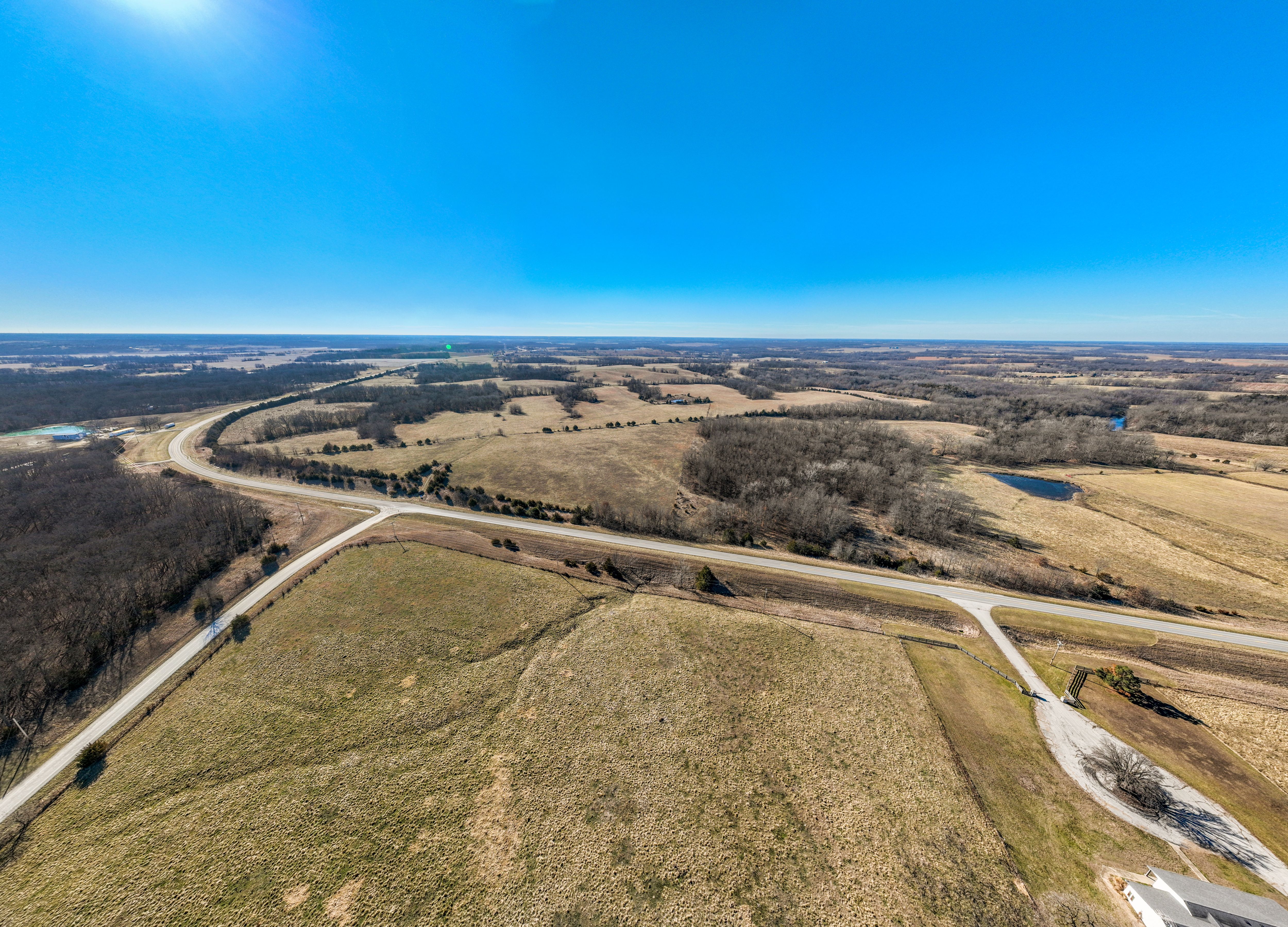
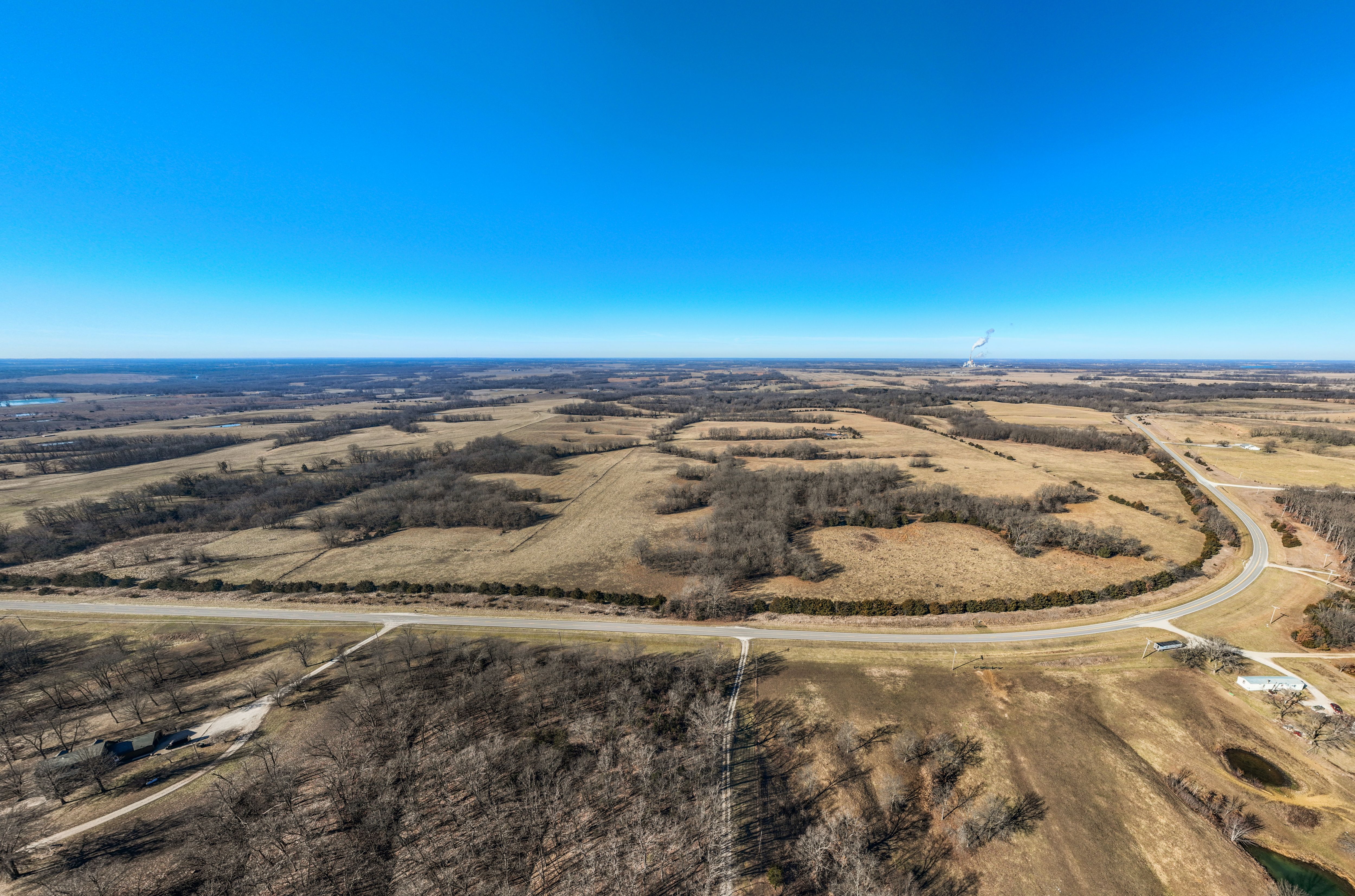
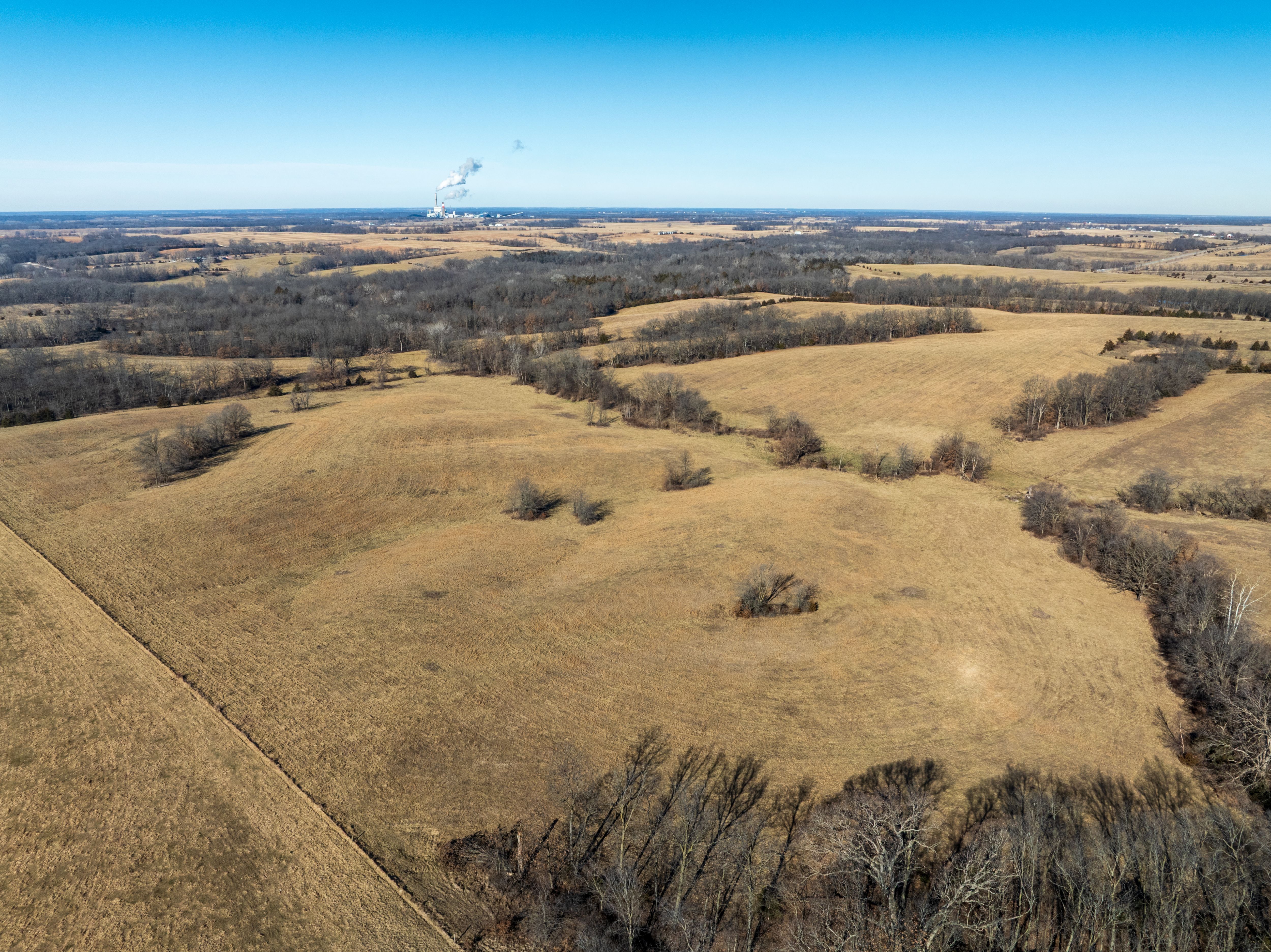
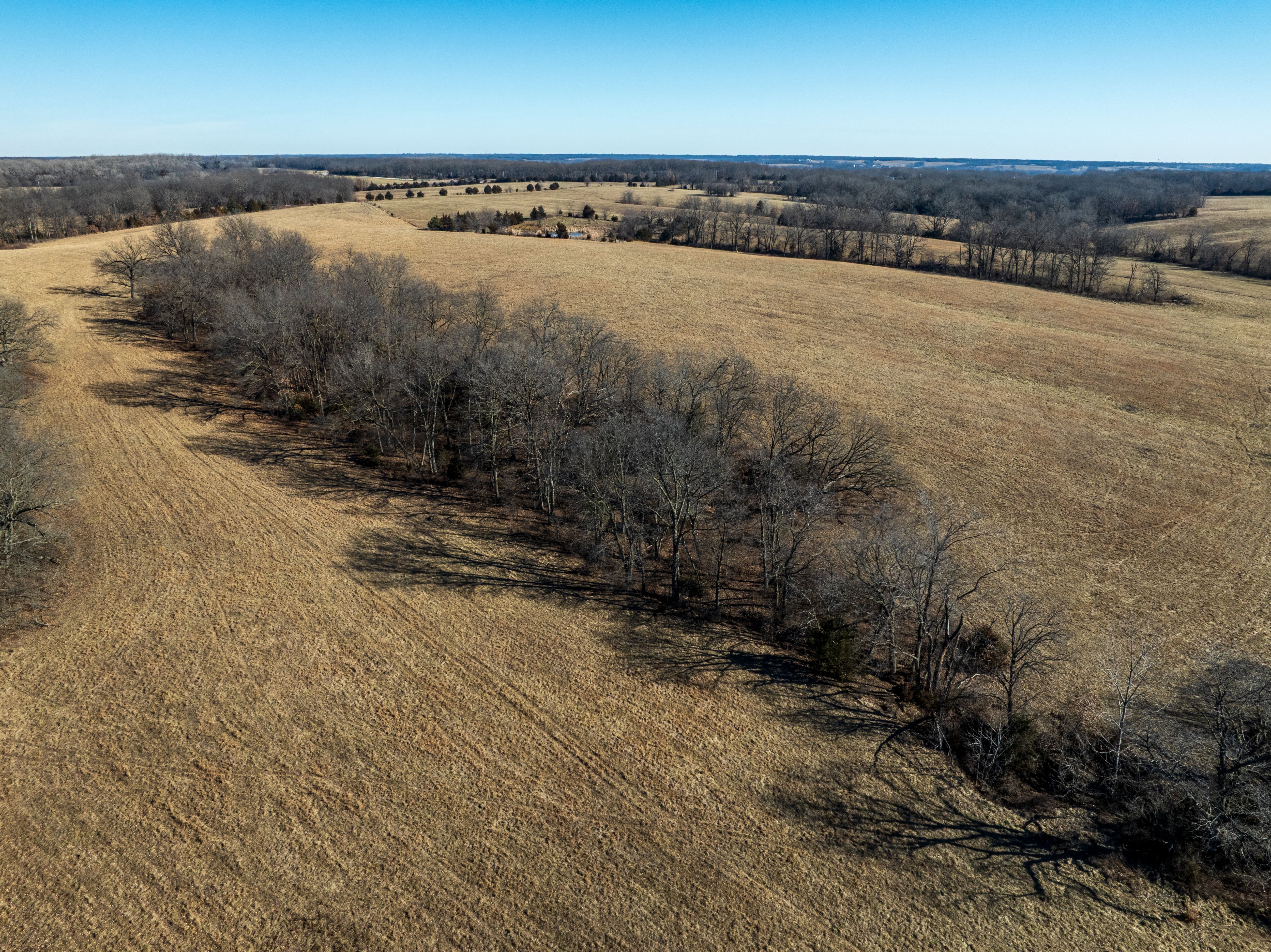
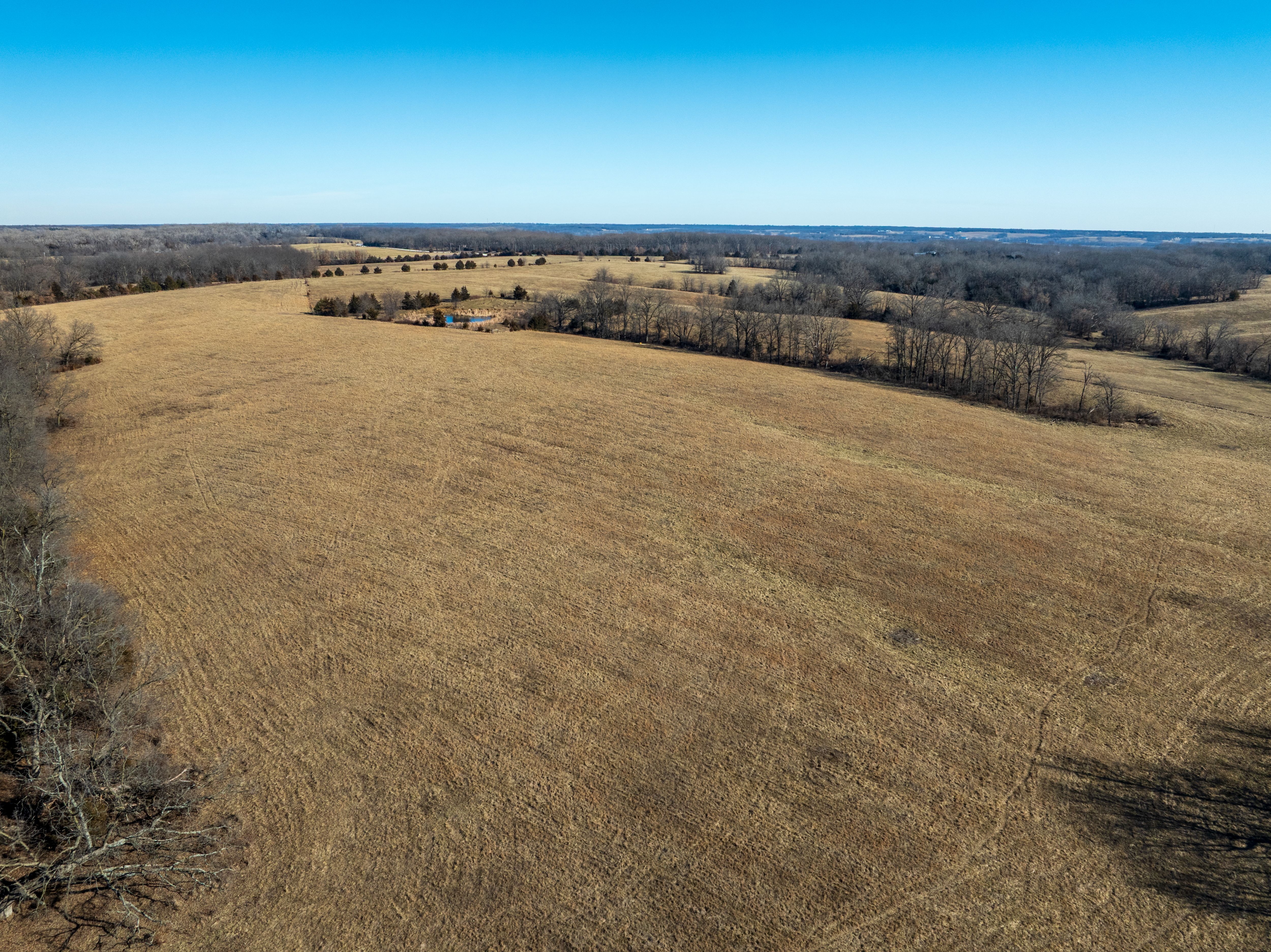
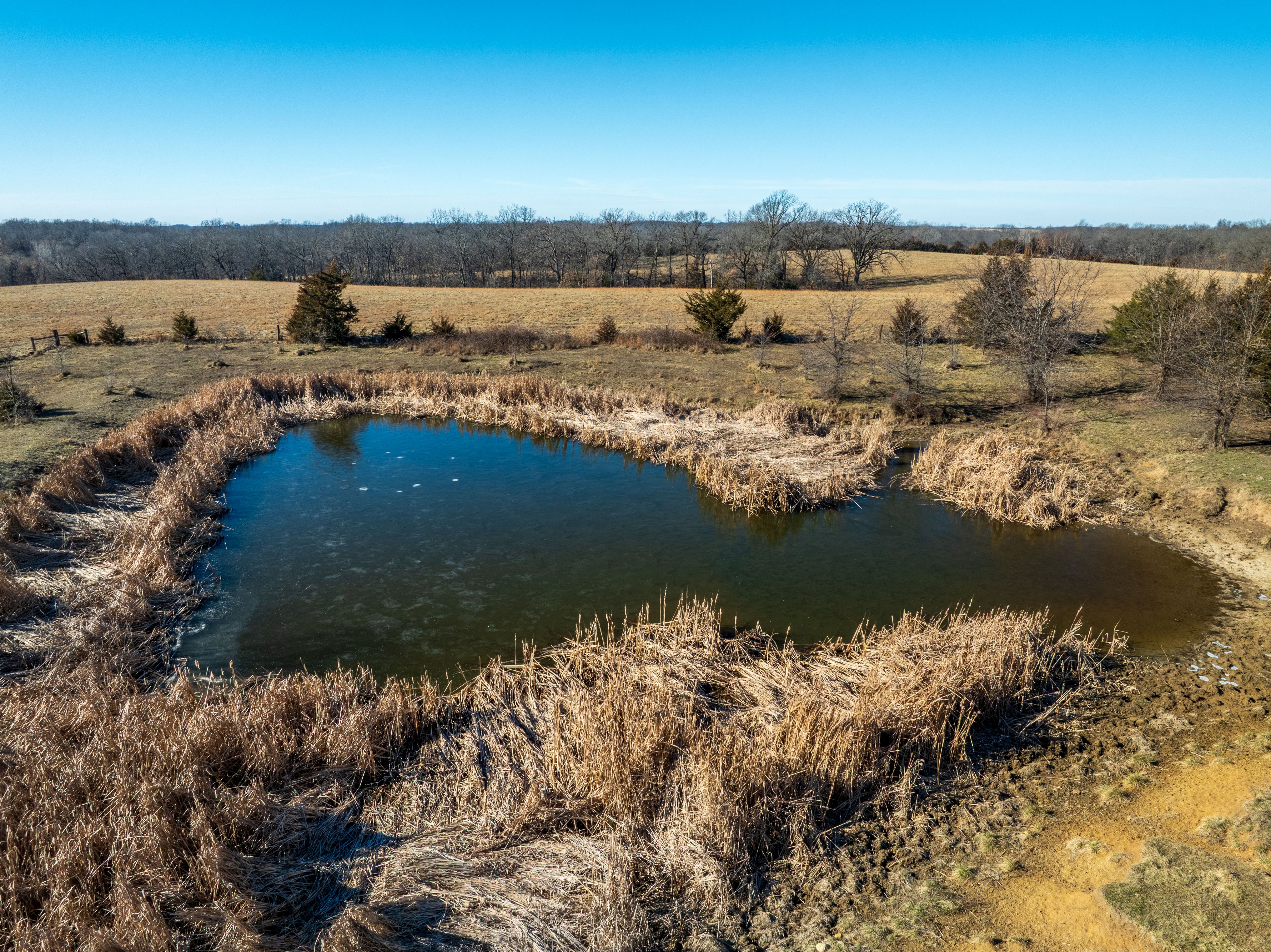
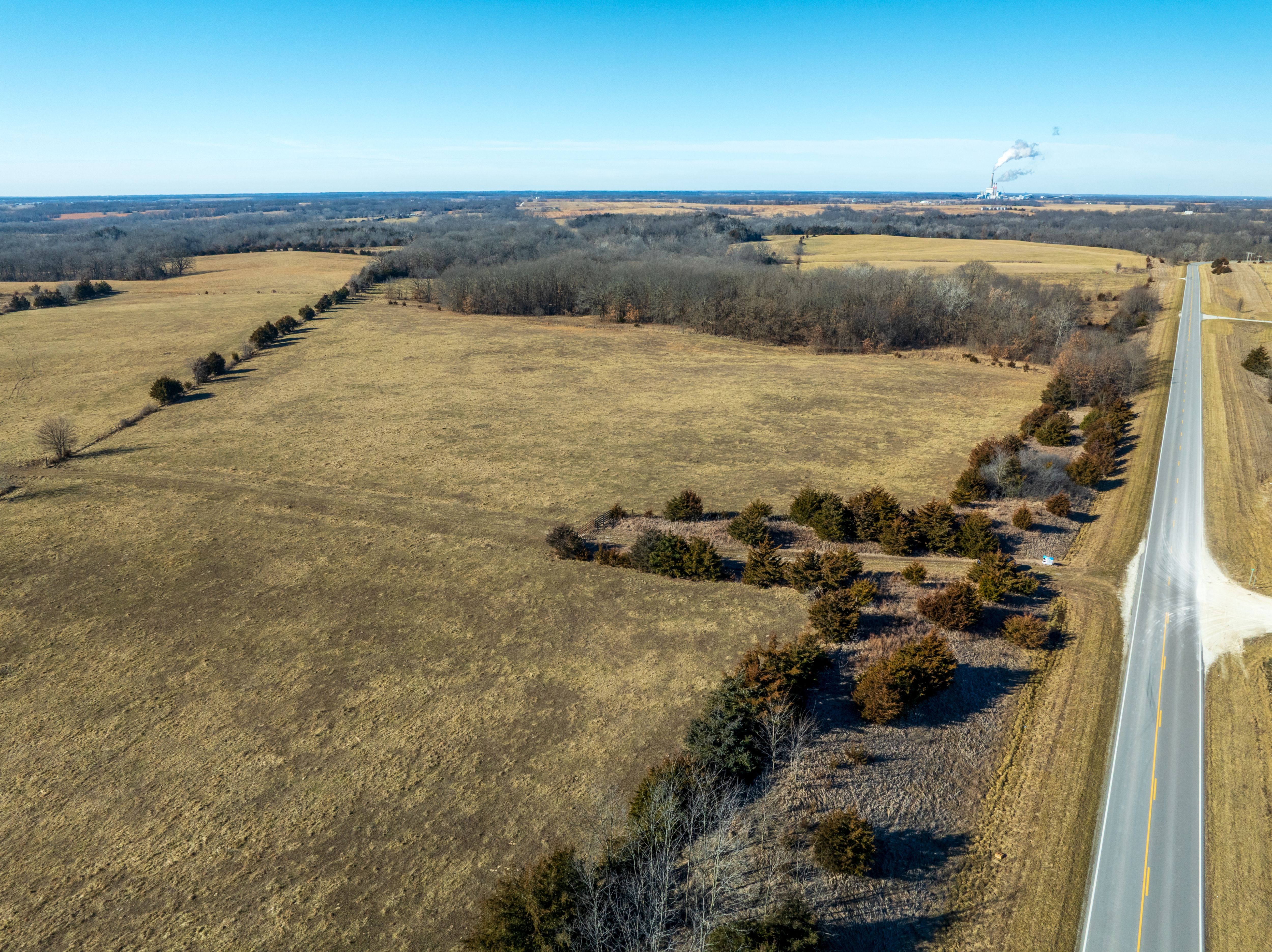
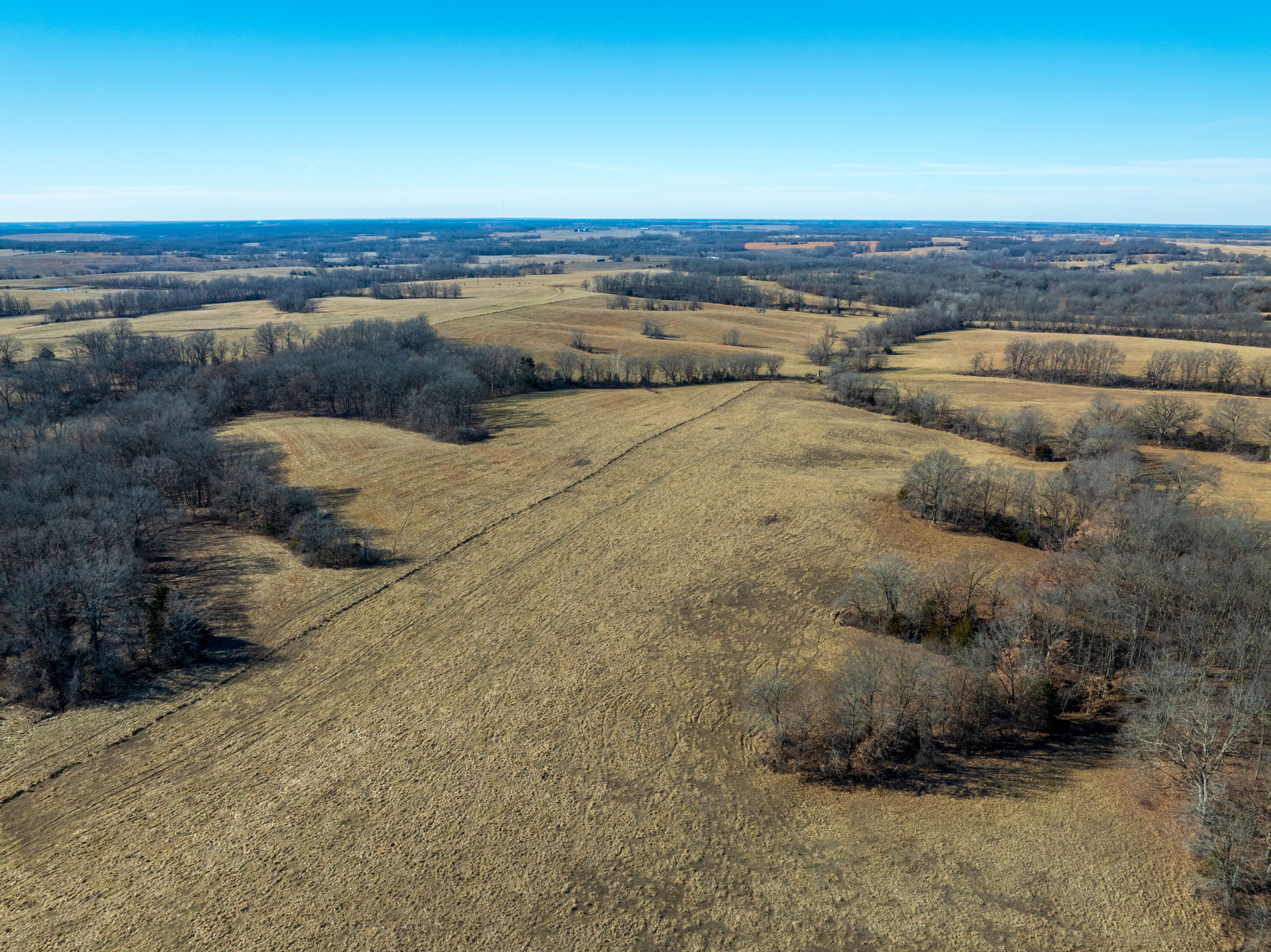
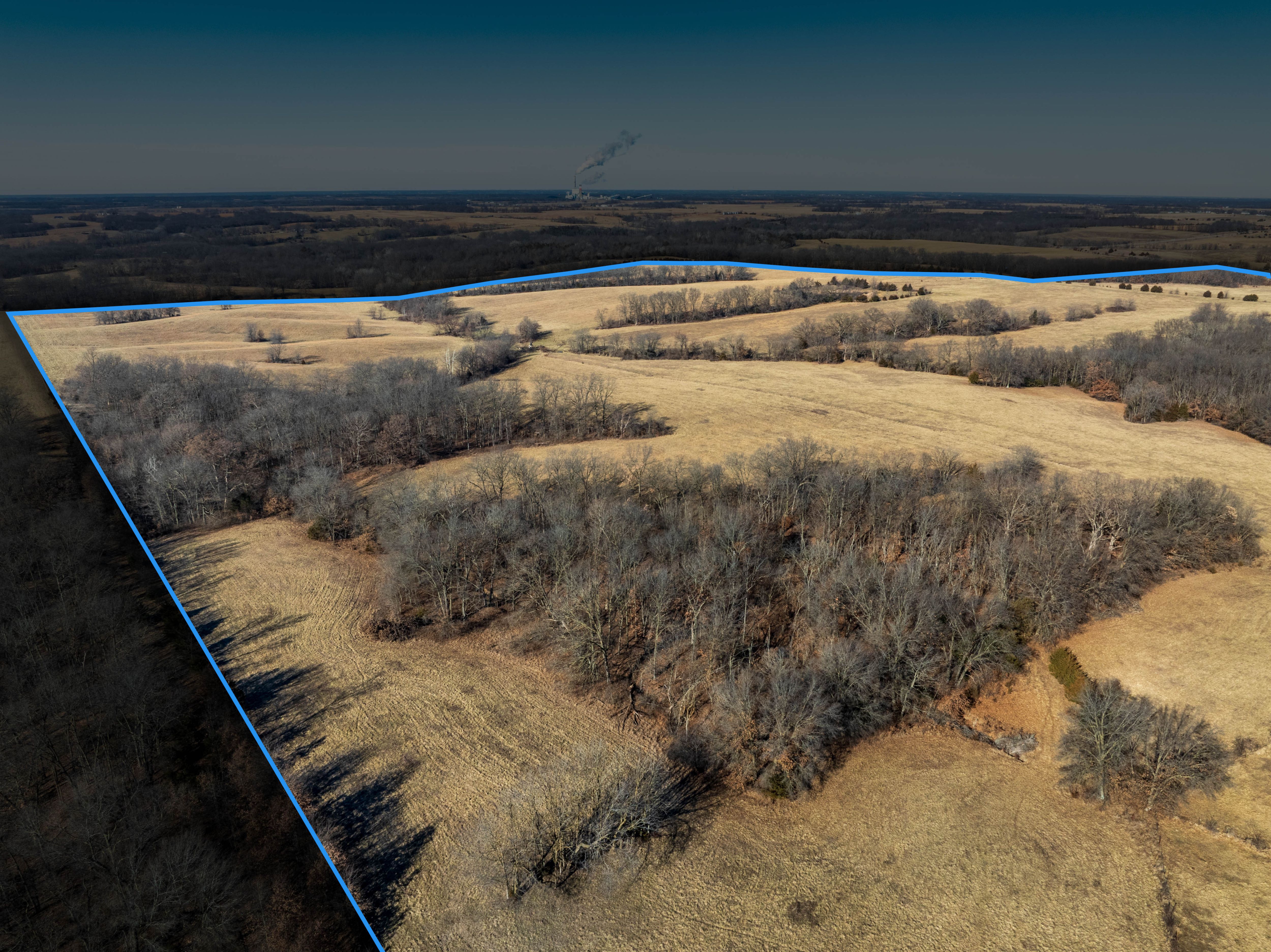
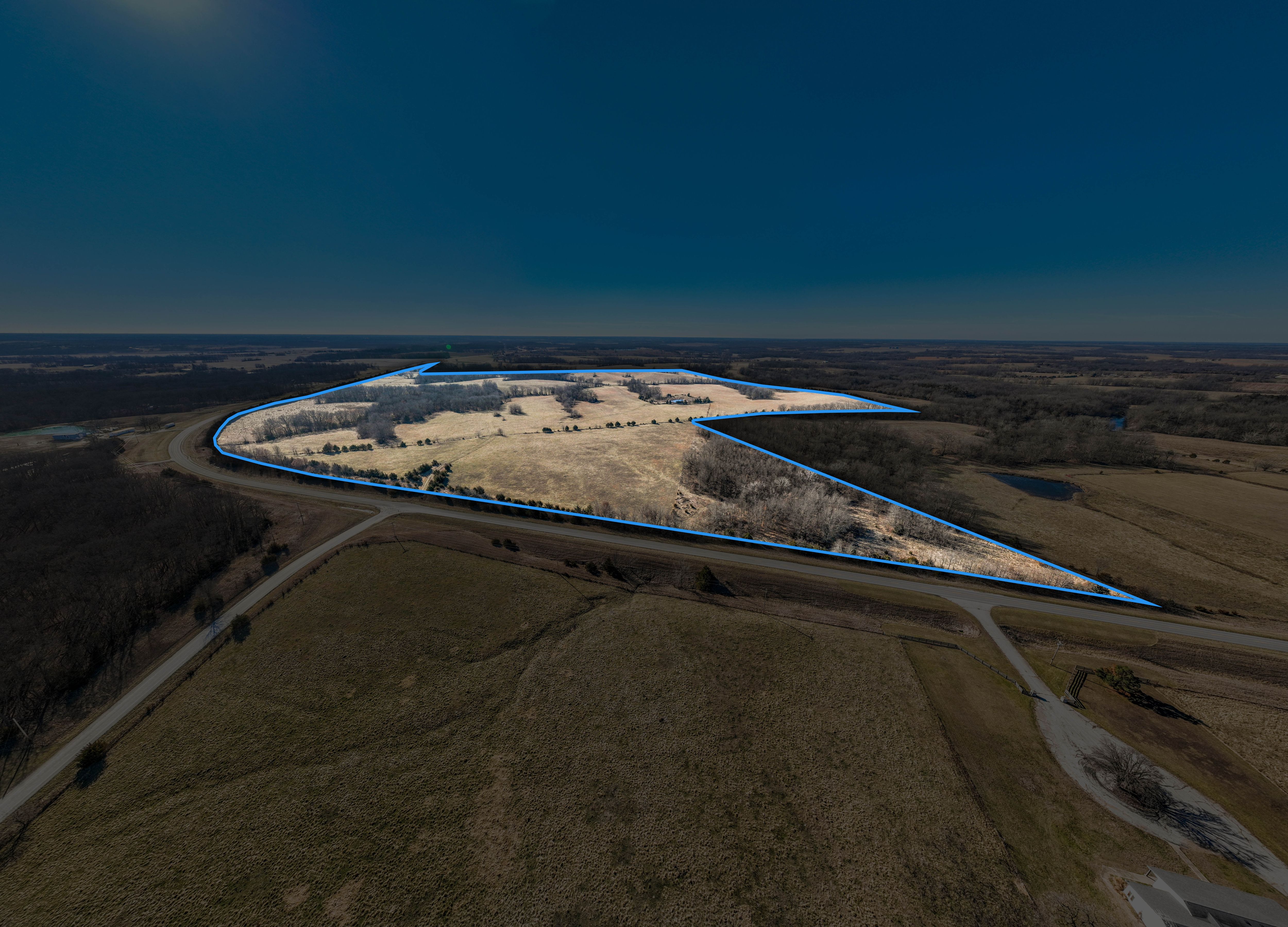
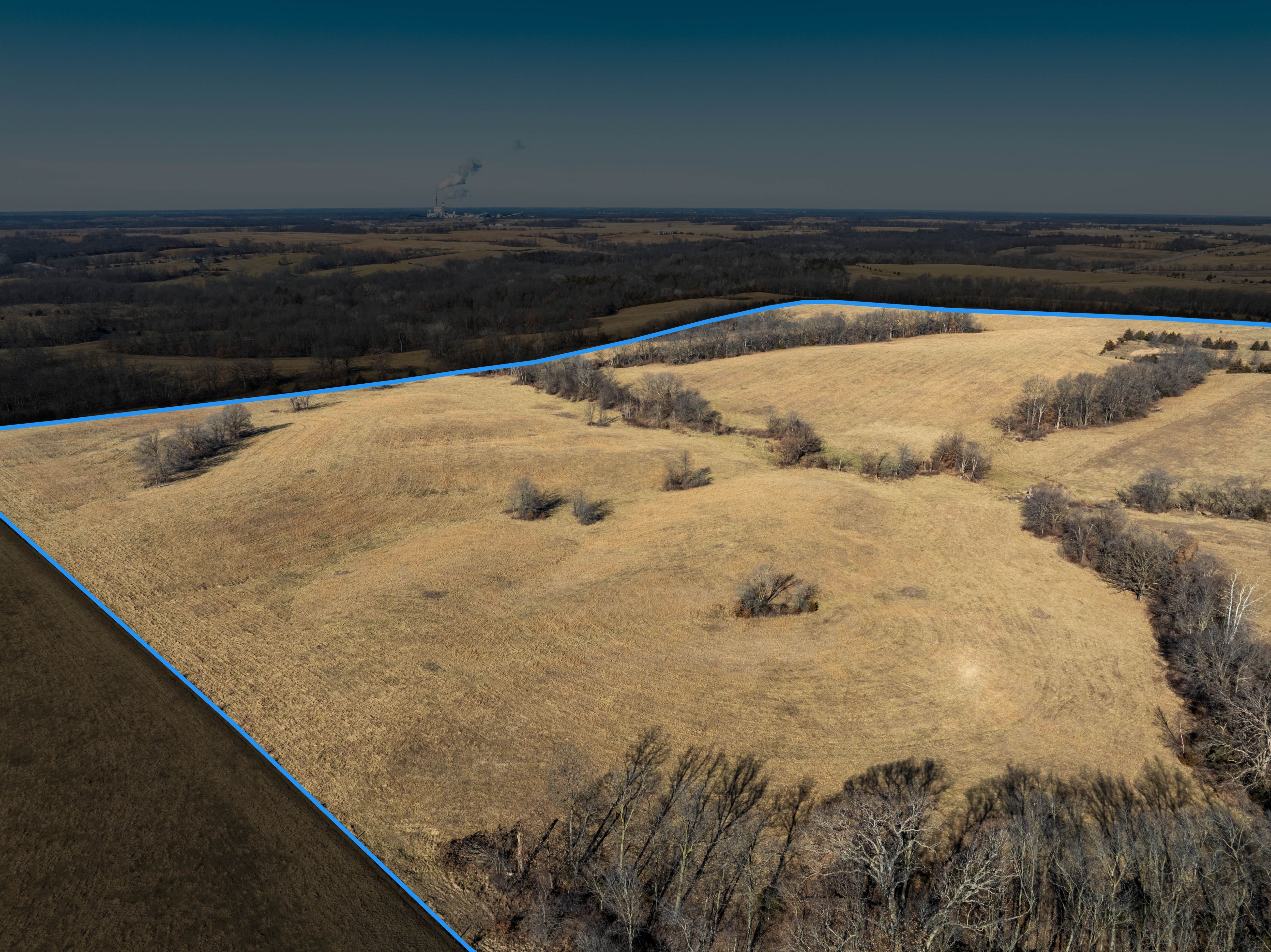
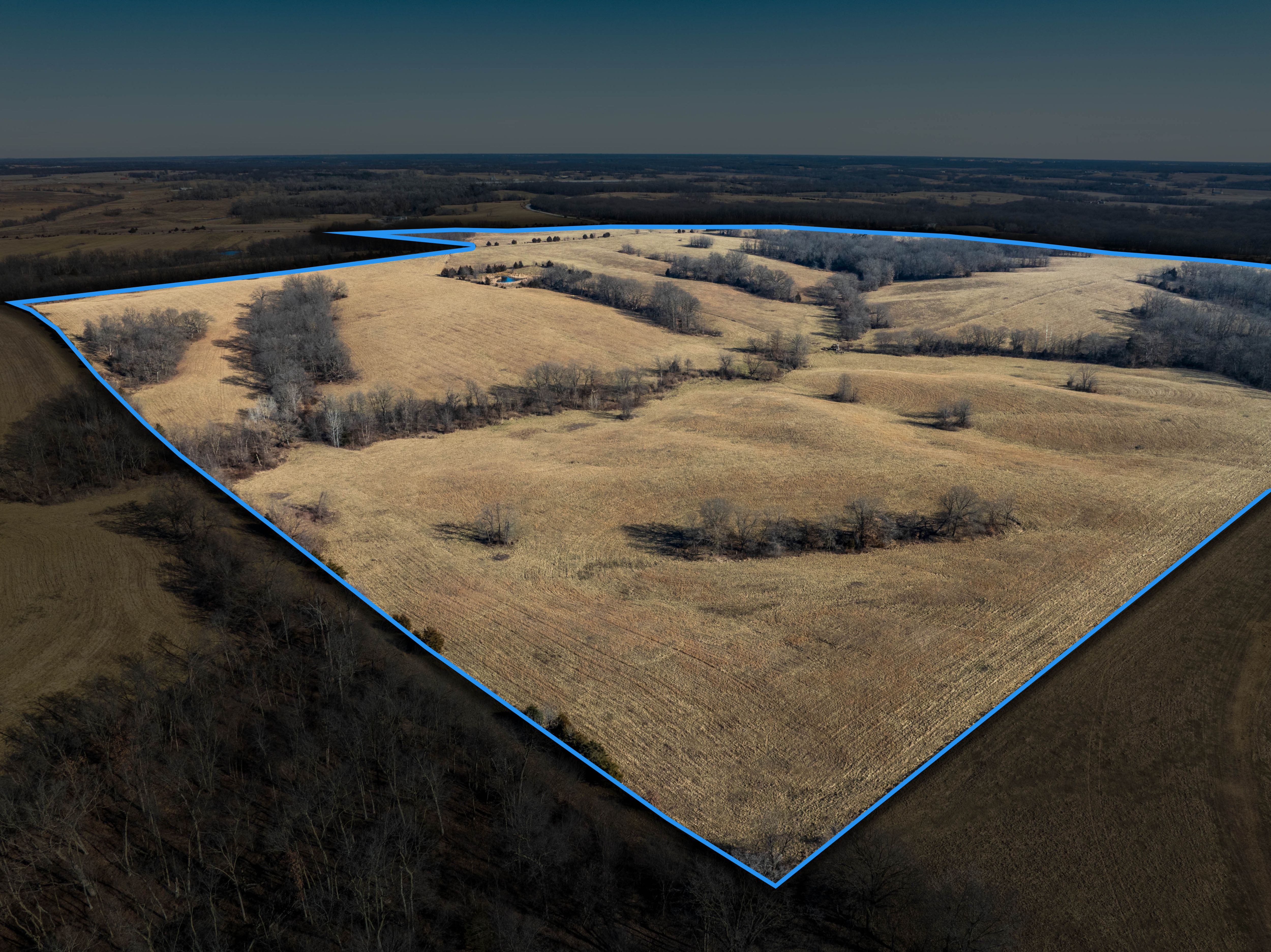
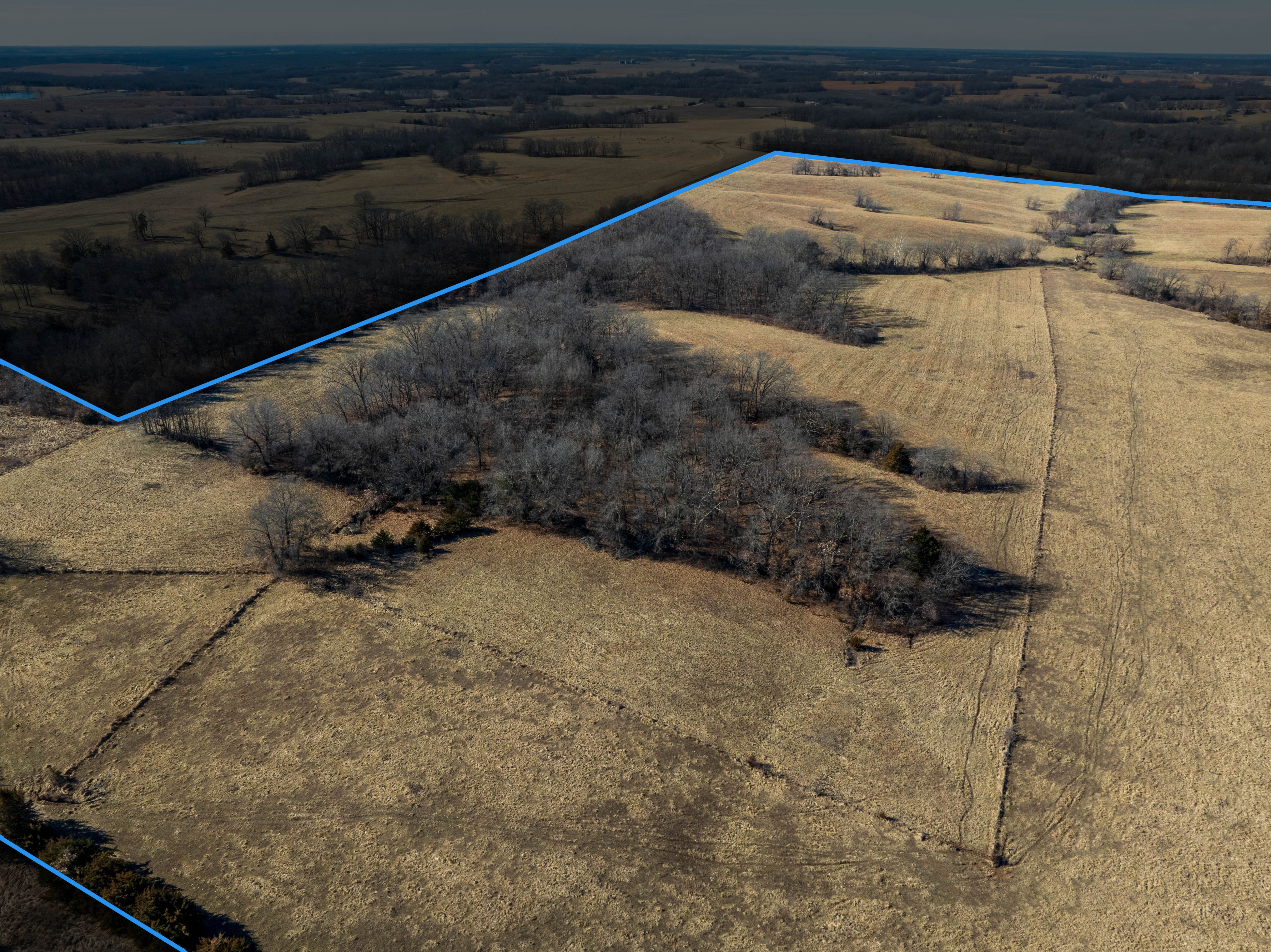
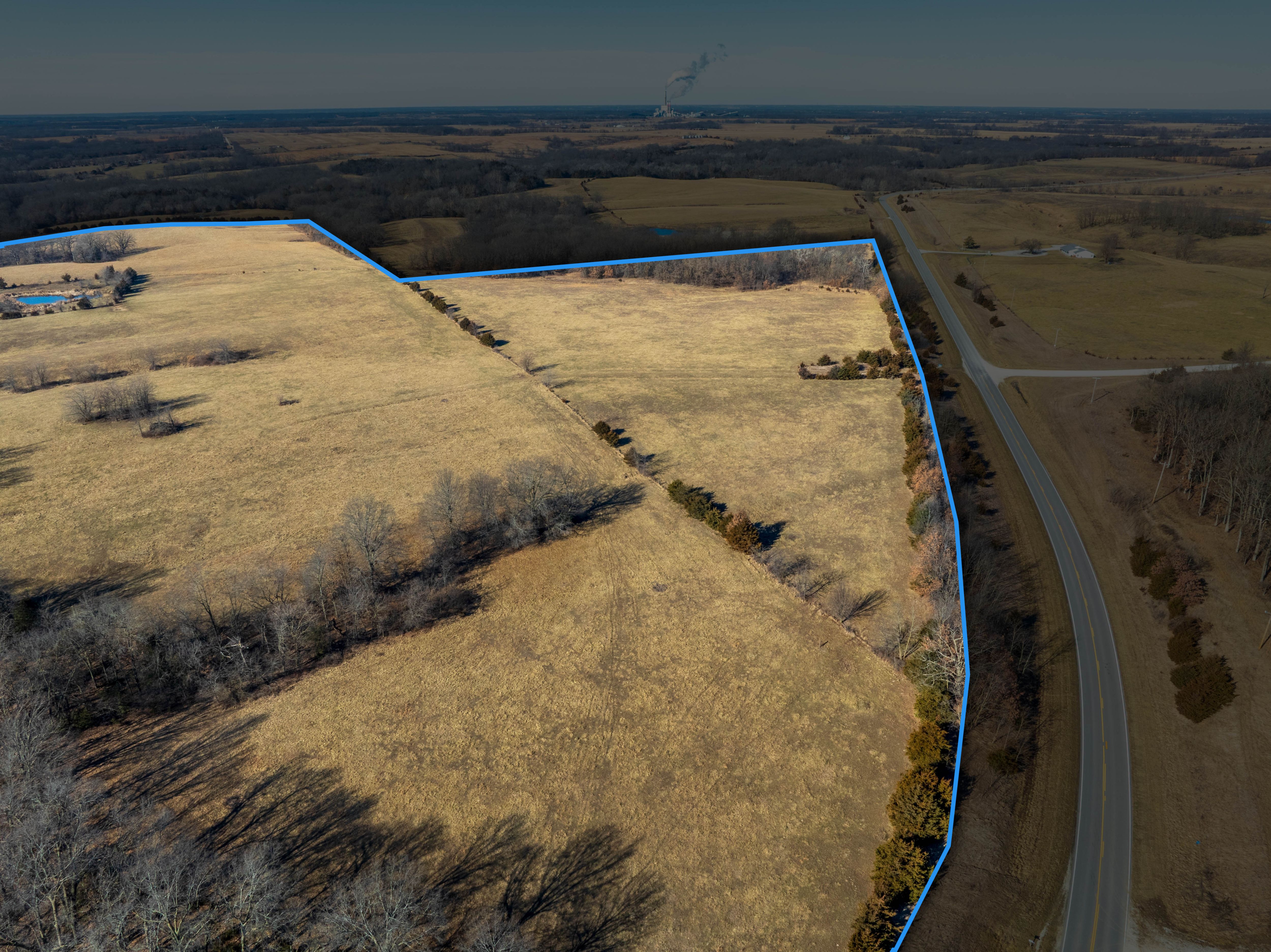
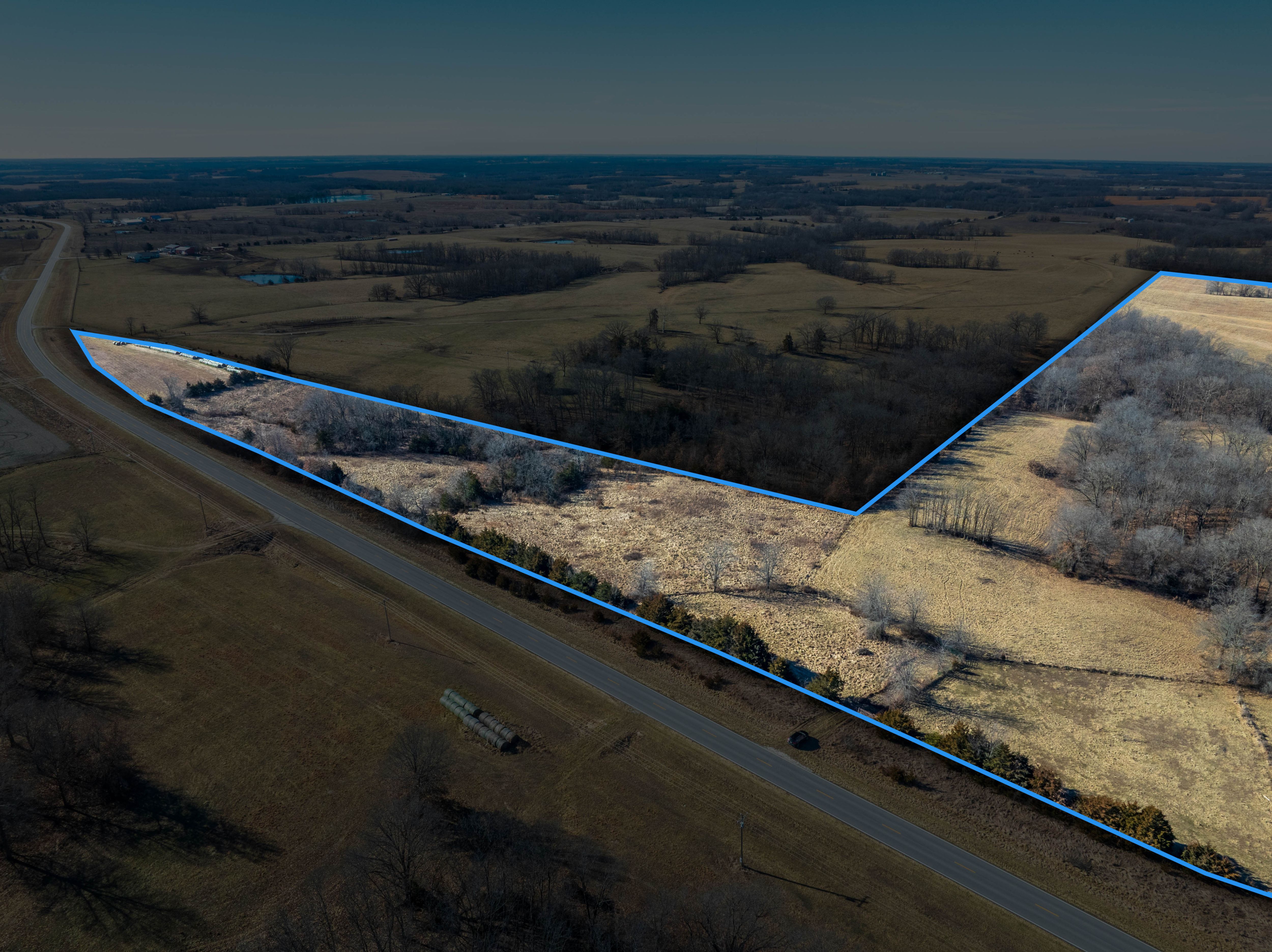
Central Missouri Cattle Farm
Pending
Randolph County, MO
215.01 Acres M/L
215.01 Acres M/L
State Highway C & County Road A70
Huntsville, MO 65259
| Price | Click to Bid Online |
| Listing | #18391 |

Property Info
Description
Legal Description
Directions
Improvements
- Parcel Number: 03-7.0-35.0-0.0-000-006.000,03-8.0-34.0-0-000-008.000
- School District: Randolph County School District
- General Area: Randolph County
- Net Taxes: $182.67
- Water: Public water available on opposite side of Hwy C.
- Zoning: Agriculture
Interactive Map
Use the Interactive Map to explore the property's regional location. Zoom in and out to see the property's surroundings and toggle various mapping layers on and off in the Map Layer Menu.
Bid Now
Auction Details & Terms
ONLINE ONLY
Randolph County Land Auction NO RESERVE
215 Acres M/L
Bidding:
Opens: March 2nd, 2026 at 9:00am CT
Closes: March 12th, 2026 at 2:00pm CT
Viewing Day:
February 14th, 2026 at 9:00am-1:00pm CT
Seller:
Inez Hickam Trust
Inez Hickam Trust
How to Register to Bid: Go to Peoplescompany.com and click the "Auctions" tab, open up the Peoples Company auction you are interested in. Click on any of the "BID NOW" icons within that auction. This will take you to our Online Bidding platform. Find the portion of the auction you wish to participate in and open it up. To participate in that auction, click "REGISTER TO BID". From there you will need to create a bidder account. Once that is created you are able to bid on any of the parcels in our Online Auction.
Auction Method: The farmland will be sold as one individual tract on a price per acre basis to the highest bidder.
Bidder Registration: All prospective bidders must register with Peoples Company and receive a bidder number in order to bid at the auction.
Farm Program Information: Farm Program Information is provided by the Randolph County Farm Service Agencies. The figures stated in the marketing material are the best estimates of the Seller and Peoples Company; however, Farm Program Information, base acres, total crop acres, conservation plan, etc. are subject to change when the farm is reconstituted by the Randolph County FSA and NRCS offices.
Mineral Rights: All mineral rights owned by seller convey to buyer at closing.
Earnest Money Payment: A 10% earnest money payment is required on the day of the auction. The earnest money payment may be paid in the form of check or wire transfer. All funds will be held in the True Line Title Company Trust Account.
Closing: Closing will occur on or before April 10th, 2026. The balance of the purchase price will be payable at closing in the form of guaranteed check or wire transfer.
Possession: Possession of the farm will be given At Closing.
Fences: Existing fences, if any, are in as-is condition and will not be updated or replaced by the Sellers. Existing fence lines may not fall directly on the legal boundary.
Contract & Title: Immediately upon the conclusion of the auction, the high bidder will enter into a real estate sales contract and deposit with True Line Title Company the required earnest money payment. The Seller will provide title work at their expense. Sale is not contingent upon buyer financing.
Other: This sale is subject to all easements, covenants, leases, and restrictions of record. All property is sold on an “As is – Where is” basis with no warranties, expressed or implied, made by the Auctioneer, Peoples Company, or Seller. All bids will be on a per-acre basis. Peoples Company and its representatives are agents of the Seller. The winning bidder acknowledges that they are representing themselves in completing the auction sales transaction. Any announcements made on auction day by the Auctioneer or Listing Agents will take precedence over all previous marketing material or oral statements. Bidding increments are at the sole discretion of the Auctioneer. All decisions of the Auctioneer are final.
Disclaimer: All field boundaries are presumed to be accurate according to the best available information and knowledge of the Seller and Peoples Company. Overall tract acres, tillable acres, etc. may vary from figures stated within the marketing material. Buyer should perform his/her own investigation of the property prior to bidding at the auction. The brief legal descriptions in the marketing material should not be used in legal documents. Full legal descriptions will be taken from Abstract.
Photos