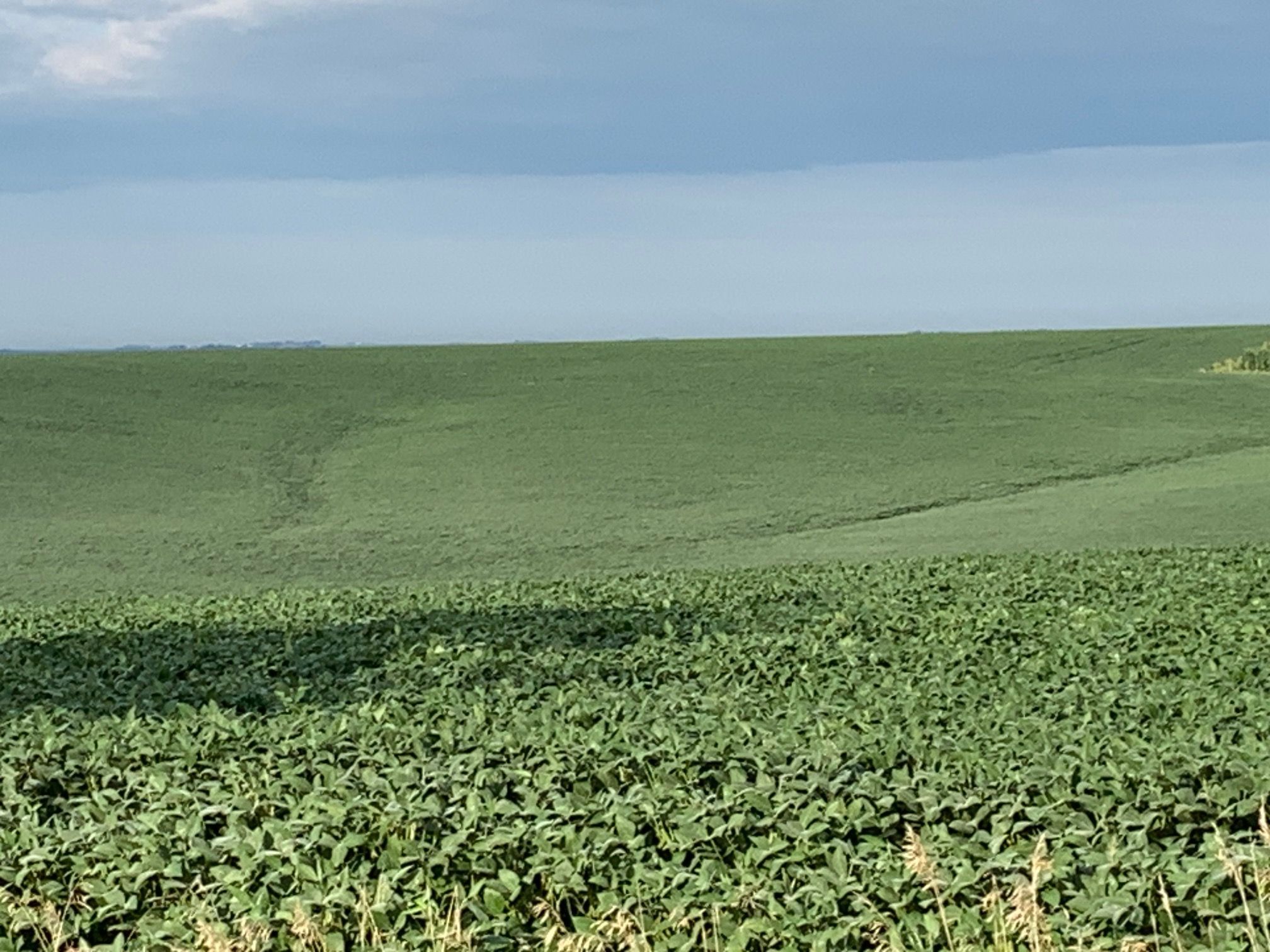
Income-Producing Nebraska Cropland, Thurston County Nebraska, Strong Soils & Excellent Accessibility
Upcoming Auction
Thurston County, NE
390.24 Acres M/L
390.24 Acres M/L
P Avenue
Rosalie, NE 68055
| Price | Click to Bid Online |
| Listing | #19740 |

Property Info
Description
Legal Description
Directions
Improvements
- Parcel Number: 0002500008
- School District: Bancroft-Rosalie 20C, 20-0020
- General Area: Northeast Nebraska
- Net Taxes: $20,726.28
- NCCPI: 69.5
- Zoning: AG
Additional Info
The 2025 property taxes payable in 2026 were assessed on the parent parcel (Parcel No. 0002500008). As the parcel was not divided in 2025, Thurston County has not established separate tax assessments for the individual tracts. The following tax amounts are estimates only and have been prorated based on the taxable acres within each tract:
Estimated 2025 Gross Real Estate Taxes (Payable 2026):
Tract 1: $12,886.10*
Tract 2: $14,756.12*
Tract 1: $12,886.10*
Tract 2: $14,756.12*
Estimated 2025 Net Real Estate Taxes (Payable 2026):
Tract 1: $9,662.07*
Tract 2: $11,064.21*
Tract 1: $9,662.07*
Tract 2: $11,064.21*
*Tax amounts are estimated for informational purposes only and are subject to adjustment upon final assessment and allocation by Thurston County for 2026 taxes payable in 2027.
Interactive Map
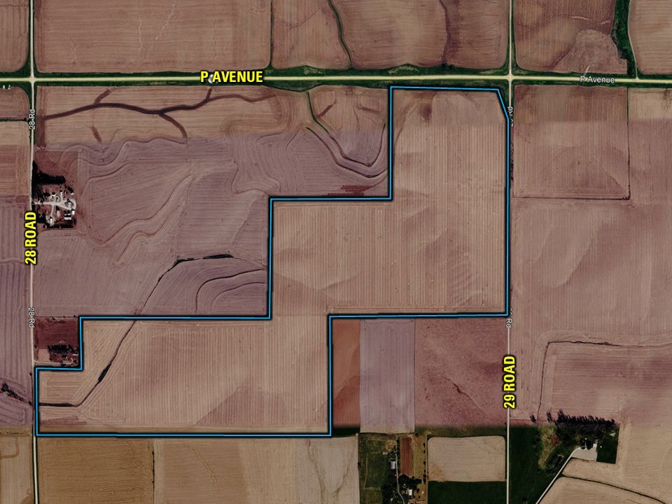
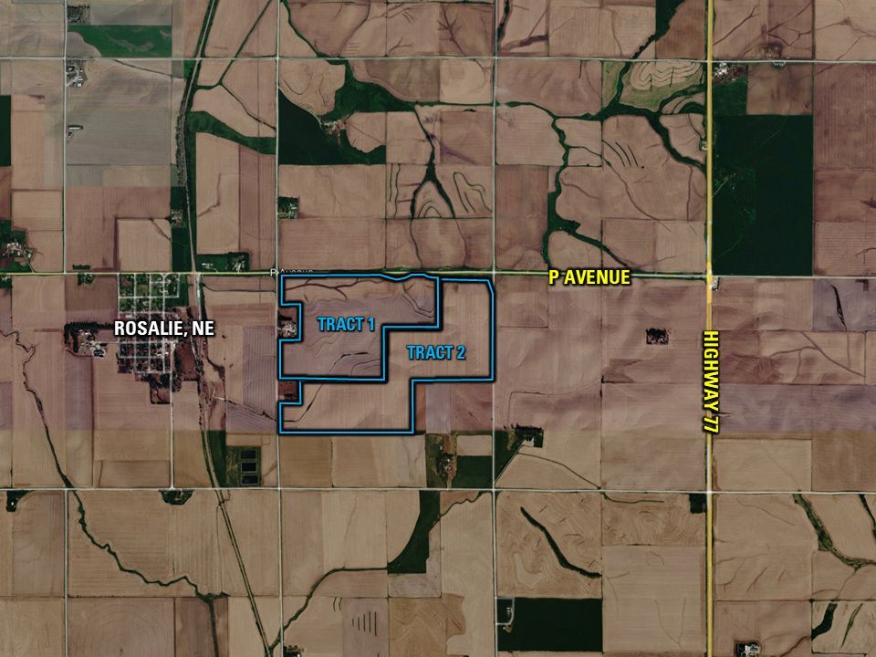
Use the Interactive Map to explore the property's regional location. Zoom in and out to see the property's surroundings and toggle various mapping layers on and off in the Map Layer Menu.
Tracts
Description
Legal Description
Improvements
Details
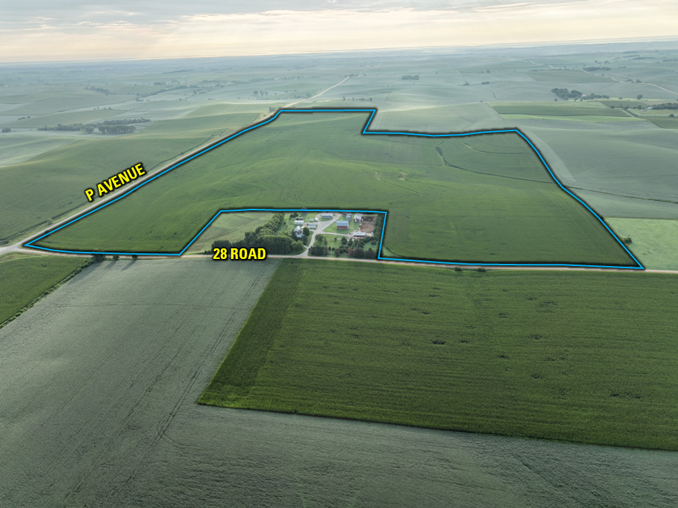
- Acres: 181.92 Acres M/L
- Net Taxes: $9,662.07
- NCCPI: 70.7
Directions
Description
Legal Description
Details
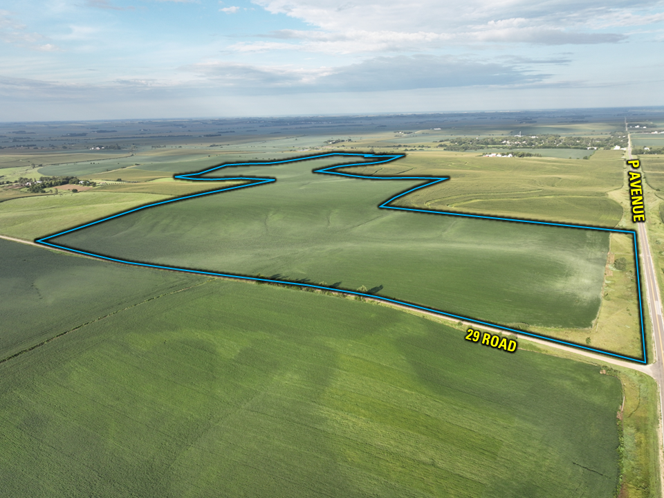
- Acres: 208.32 Acres M/L
- Parcel Number: part of 0002500008
- Net Taxes: $11,064.21
- NCCPI: 68.3
Directions
Bid Now
Auction Details & Terms
Thurston County Land Auction
390.24 Acres M/L (Offered in Two Tracts)
Thursday, November 5, 2026 at 10:00 AM
Auction Location:
Lyons City Hall
335 Main Street
Lyons, NE 68038
Auction Method: The two tracts will be offered via Public Auction and will take place at 10:00 AM at Lyons City Hall, Lyons, Nebraska. The auction will be conducted using a Traditional Auction format, enabling buyers to bid on either tract separately or on both tracts as a combined unit. This approach offers flexibility and allows bidders to compete for the land configuration that best suits their needs.
Tract 1: 181.92 Taxable Acres M/L
Tract 2: 208.32 Taxable Acres M/L
Tracts 1&2: 390.24 Taxable Acres M/L
Survey: A survey will be completed before the November 5 auction that will establish the final acres used for all sale and closing calculations and documents.
Bidder Registration: All prospective bidders must register with Peoples Company and receive a bidder number in order to bid at the auction. Online and phone bidders must register with the Auctioneer at least 24 hours prior to the start of the auction. Peoples Company and its representatives are agents of the Seller.
Agency: Peoples Company and its representatives are agents of the Seller. Winning bidder(s) acknowledge they are representing themselves in completing the auction sales transaction.
Contract & Title: Immediately upon the conclusion of the auction, the high bidder will enter into a real estate sales contract and deposit the required earnest money payment with Lewis & Clark Title & Escrow, South Sioux City, NE. The terms of the signed Real Estate Purchase Contract shall govern the sale and shall supersede all prior negotiations, discussions, representations, or information regarding the sale, including this brochure. The Seller will furnish, at Seller’s expense, a current Title Commitment for an Owner’s Policy in the amount equal to the Total Purchase Price. Buyer will pay the premium for any title insurance policy Buyer chooses to obtain. The Seller agrees to convey marketable title to the property. This sale is not contingent on financing.
Online Bidding: Register to bid at http://peoplescompany.bidwrangler.com/. Potential bidders may have access to the live auction by utilizing Peoples Company's online auction platform via the Internet. By using Peoples Company's online auction platform, bidders acknowledge that the Internet is known to be unpredictable in performance and may, from time to time, impede access, become inoperative, or provide a slow connection to the online auction platform. Bidders agree that Peoples Company nor its affiliates, members, officers, shareholders, agents, or contractors are, in any way, responsible for any interference or connectivity issues the bidder may experience when utilizing the online auction platform.
Online Bidding: Register to bid at http://peoplescompany.bidwrangler.com/. Potential bidders may have access to the live auction by utilizing Peoples Company's online auction platform via the Internet. By using Peoples Company's online auction platform, bidders acknowledge that the Internet is known to be unpredictable in performance and may, from time to time, impede access, become inoperative, or provide a slow connection to the online auction platform. Bidders agree that Peoples Company nor its affiliates, members, officers, shareholders, agents, or contractors are, in any way, responsible for any interference or connectivity issues the bidder may experience when utilizing the online auction platform.
Farm Program Information: Farm Program Information is provided by the Thurston County Farm Service Agencies. The figures stated in the marketing material are the best estimates of the Seller and Peoples Company; however, Farm Program Information, base acres, total crop acres, conservation plan, etc., are subject to change when the farm is reconstituted by the Thurston County FSA and NRCS offices.
Earnest Money Payment: A 10% earnest money payment is required on the day of the auction. The earnest money payment may be paid in the form of a check. All funds will be held at Lewis & Clark Title & Escrow, South Sioux City, NE.
Financing: The sale of the property is not contingent upon the Buyer obtaining financing. All financing arrangements are to have been made before bid submission. By bidding, the bidder represents that he/she has the present ability to perform at the bid price and will fulfill all obligations within the Real Estate Sale and Purchase Agreement.
Closing: Closing will occur on or before Friday, December 18, 2026. The balance of the purchase price will be payable at closing via wire transfer. With respect to the timing of the Sellers and successful Buyer(s) in fulfilling their obligations under the Real Estate Purchase Contract, time is of the essence. Escrow and closing will take place at Lewis & Clark Title and Escrow in South Sioux City, Nebraska.
Possession: Possession of the farm will be given at closing.
Property Tax: Seller shall credit Buyer at closing for 2026 real estate taxes due in 2027 based on the 2025 taxes payable in 2026 (Tract 1: $9,662.07*; Tract 2: $11,064.21*). Actual 2026 taxes payable in 2027 will not be available prior to closing, and any difference between the credited amount and the actual taxes due shall be the responsibility of the Buyer..
Mineral Rights: The Property is being sold subject to all prior reservations, conveyances, exceptions, leases, and severances of mineral rights. Seller does not own all mineral rights underlying the Property and makes no warranty, express or implied, concerning the nature, extent, marketability, or value of any mineral interests. Purchasers shall acquire only those mineral interests, if any, actually owned by Seller at closing. No adjustment to the purchase price shall be made based upon the quantity or quality of mineral interests conveyed.
Farm Lease: Farm is available for the 2027 crop year. Current tenant has been notified in writing of lease termination.
Other: This sale is subject to all easements, covenants, leases, and restrictions of record. All property is sold on an “As is – Where is” basis with no warranties, expressed or implied, made by the Auctioneer, Peoples Company, or Seller. All bids will be on a per-acre basis. Peoples Company and its representatives are agents of the Seller, which can accept or reject any and all bids. The winning bidder(s) acknowledge that they are representing themselves in completing the auction sales transaction. Any announcements made on auction day by the Auctioneer or Listing Agents will take precedence over all previous marketing material or oral statements. Bidding increments are at the sole discretion of the Auctioneer. No absentee or phone bids will be accepted at the auction without prior approval of the Auctioneer. All decisions of the Auctioneer are final.
Fences: Existing fences, if any, are in as-is condition and will not be updated or replaced by the Sellers. Not all tract and boundary lines are fenced, and if needed, they will be the responsibility of the Buyer at closing. Existing fence lines may not fall directly onto the legal boundary.
Disclaimer: All field boundaries are presumed to be accurate according to the best available information and knowledge of the Seller and Peoples Company. Overall tract acres, tillable acres, etc., may vary from figures stated within the marketing material. The buyer should perform his/her investigation of the property before bidding at the auction. The brief legal descriptions in the marketing material should not be used in legal documents. A full legal description for each tract will be provided by the title company prior to closing. At the time of this auction, Tracts 1 and 2 are included within Thurston County Parcel # 0002500008, currently described as NE¼ Less Highway; NW¼ Less Tract; N½ SW¼ Less Tract; W½ NW¼ SE¼, Section 14, Township 24 North, Range 8 West, Dawes Township, Thurston County, Nebraska. As the tracts have not been assigned separate parcel numbers by Thurston County, individual legal descriptions and 2025 real estate tax information for Tract 1 and Tract 2 are not currently available.
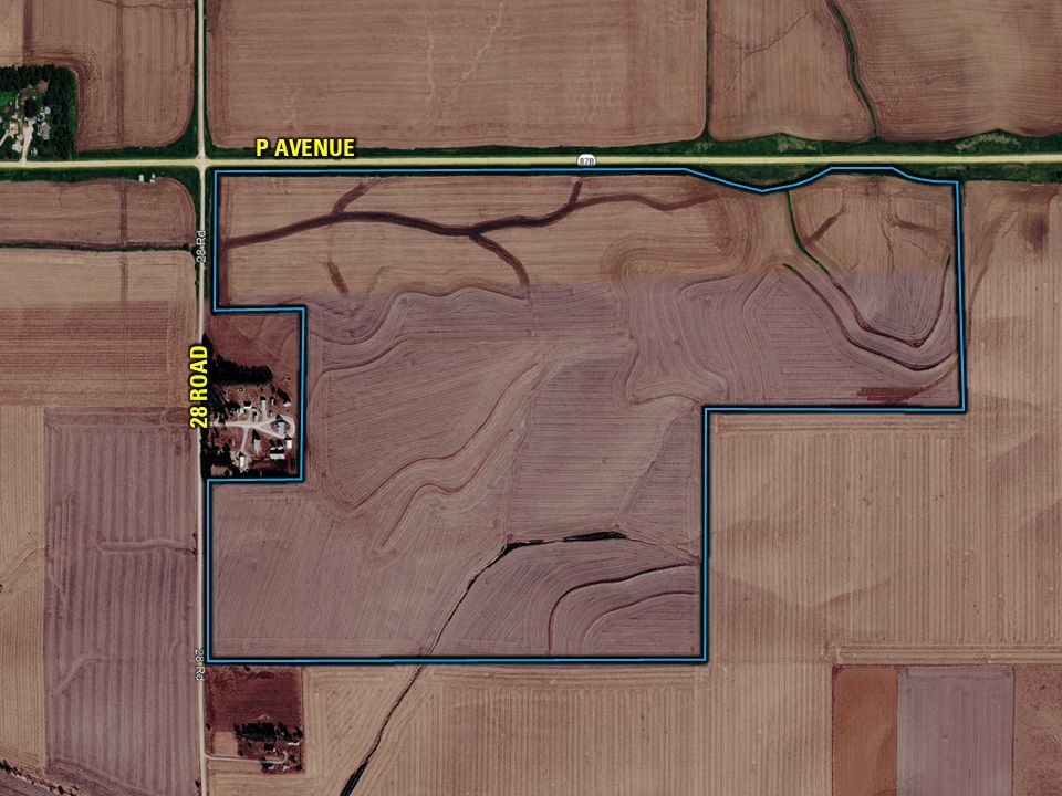
Lines depicted on photographs and maps are approximate and have been provided solely for illustrative purposes. Actual property boundaries are subject to survey and legal description.
Photos
Tract 1 Photos
.JPG)
.JPG)
.JPG)
.JPG)
.JPG)
.JPG)
.JPG)
.JPG)
Tract 2 Photos
.JPG)
.JPG)
.JPG)
.JPG)
.JPG)
.JPG)
.JPG)
.JPG)
.JPG)