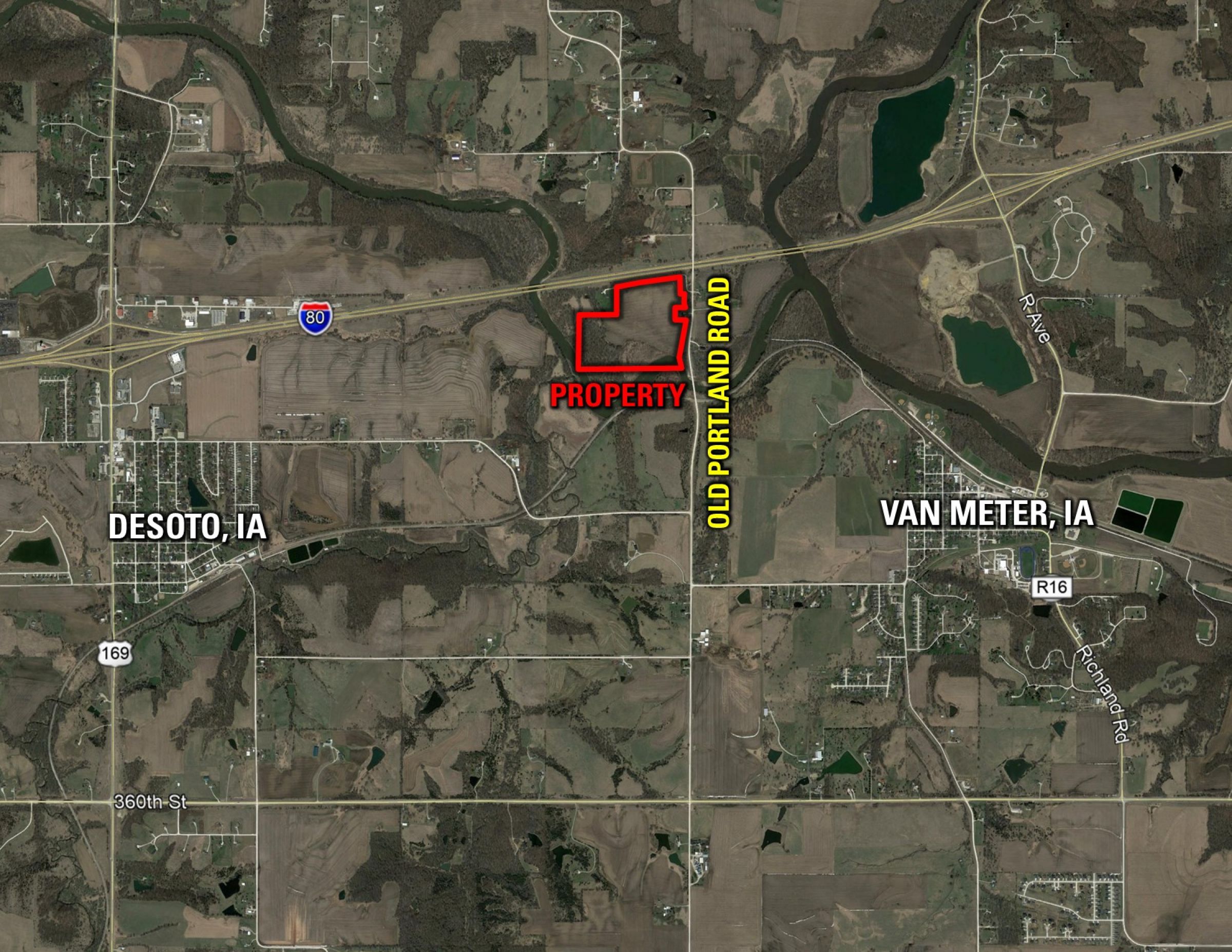
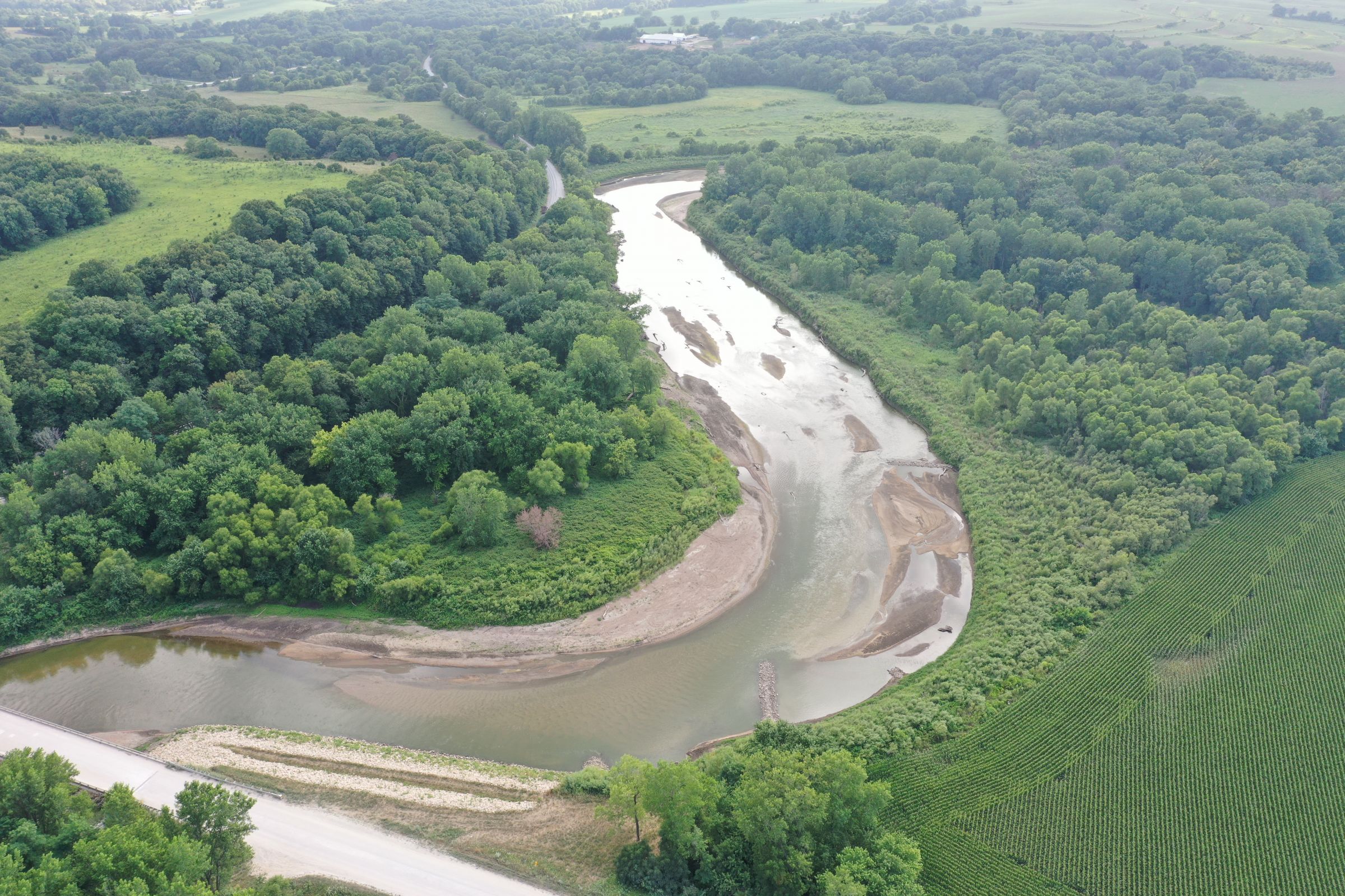
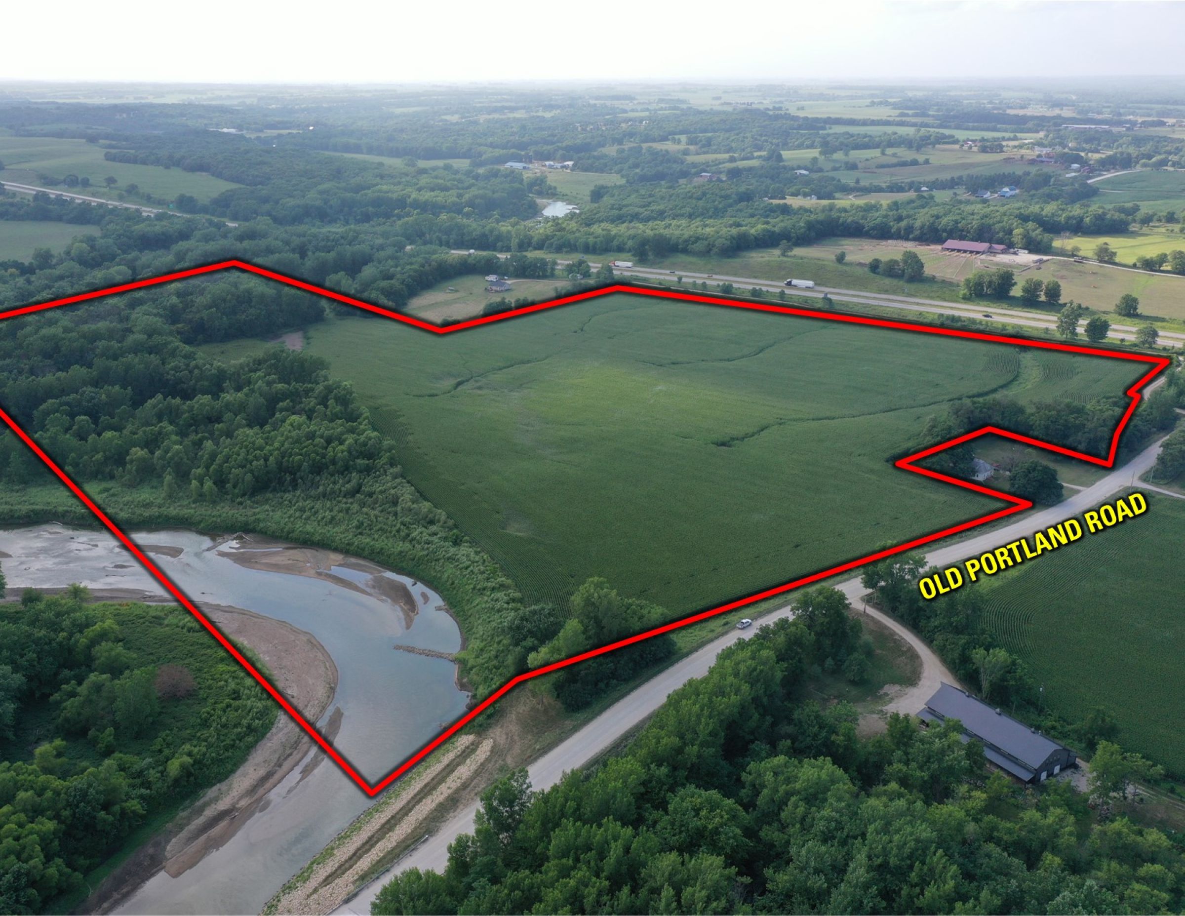
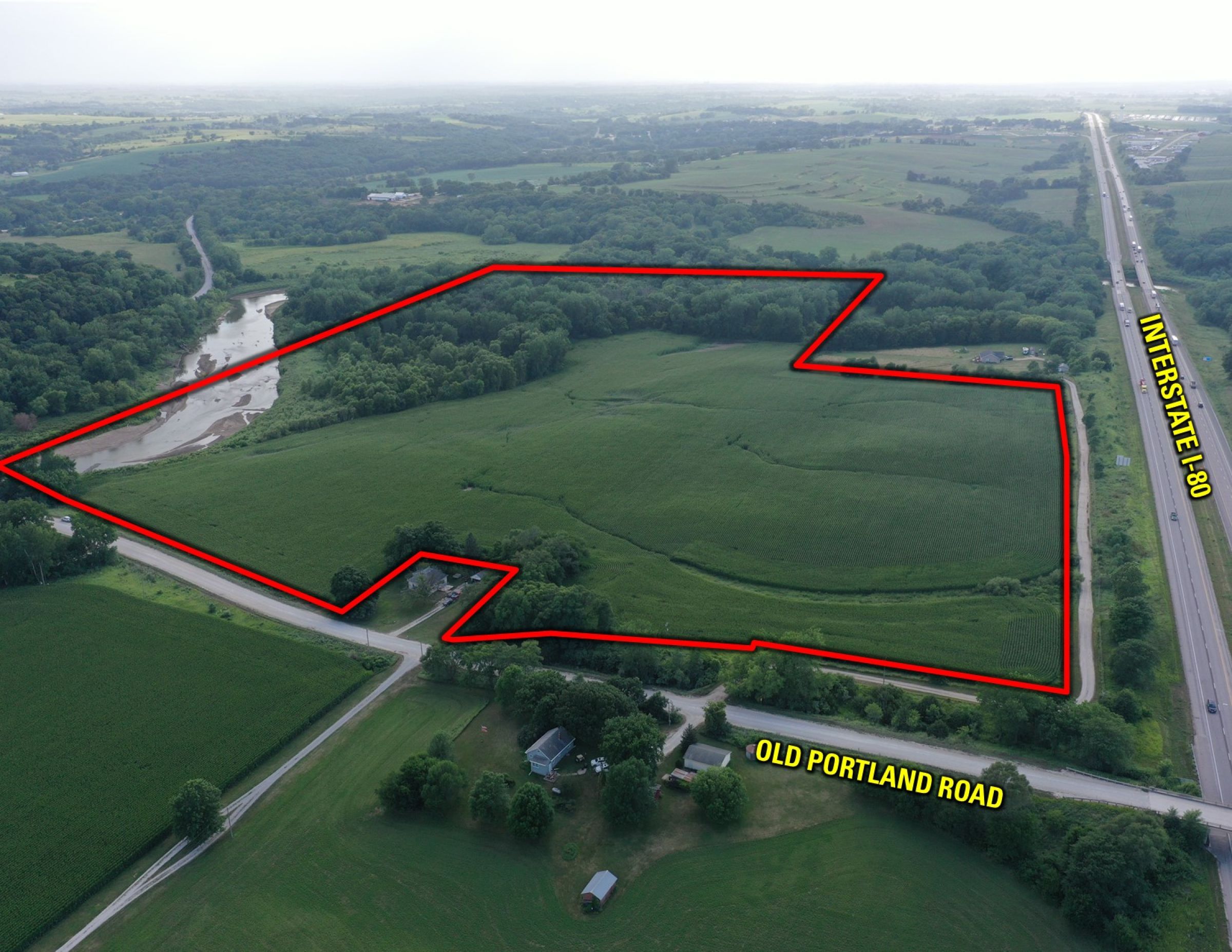
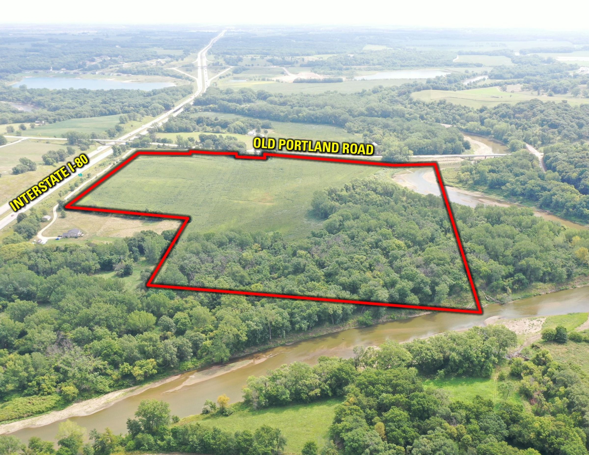
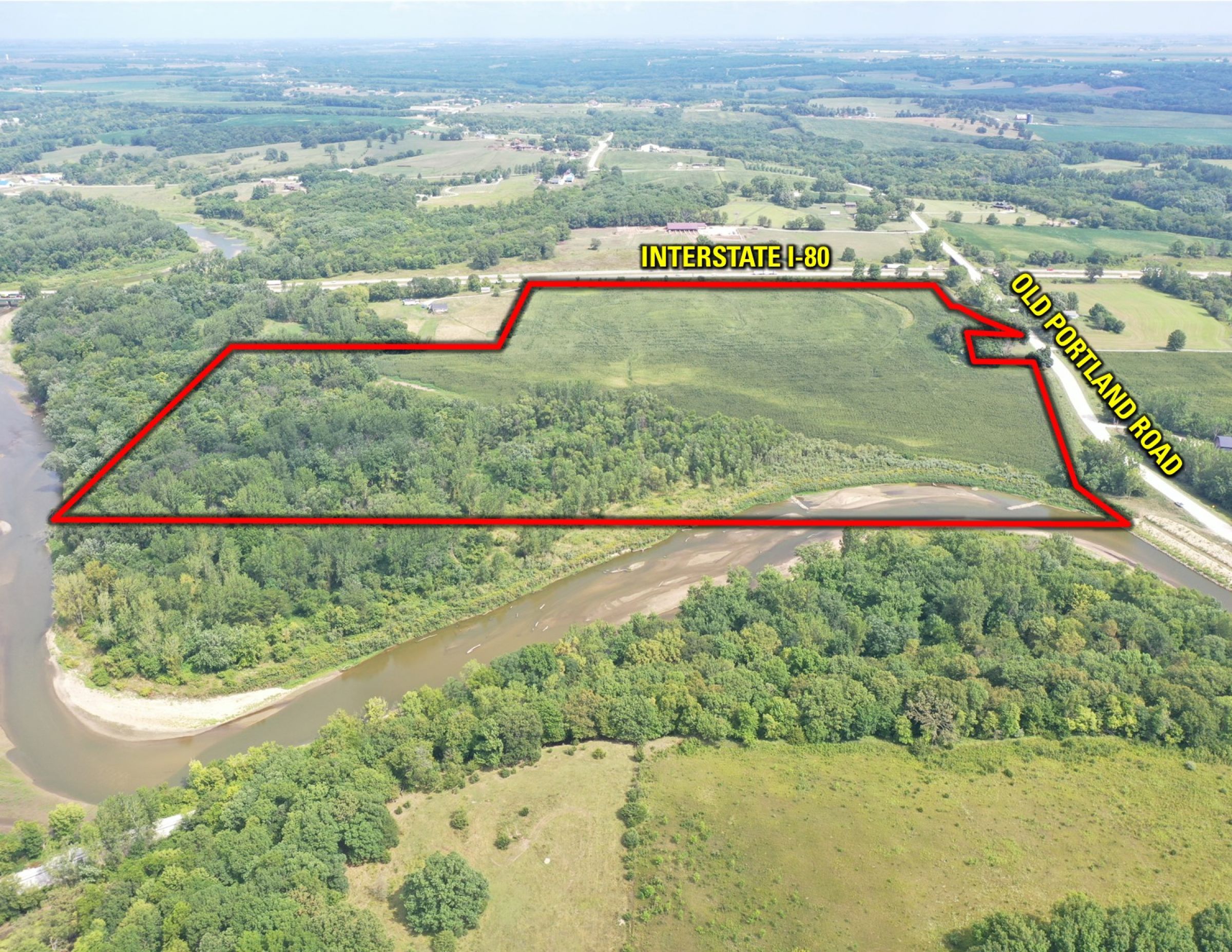
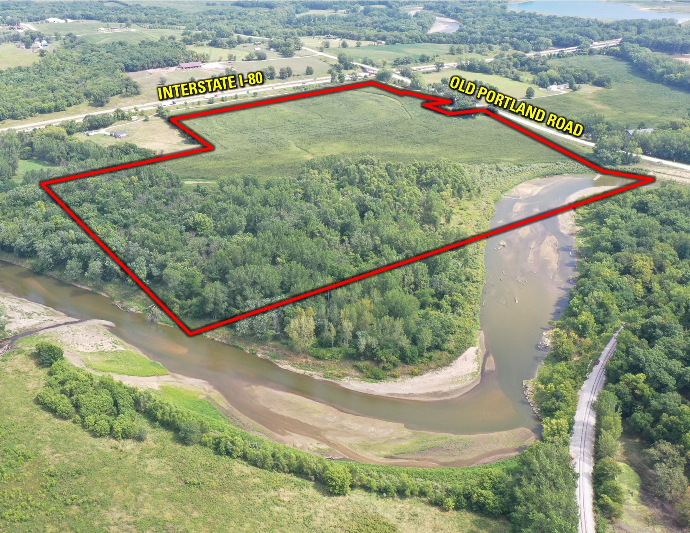
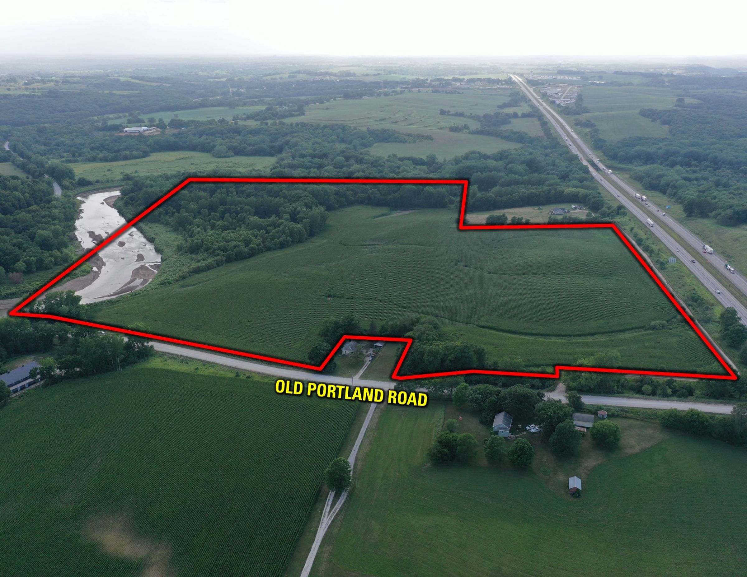
Dallas County, IA
61.50 Acres M/L

Old Portland Road
Van Meter, IA 50261
Listing #15114

Sold

$676,500

Property Info

Description

Farmland available in Dallas County! This land which is located on the west side of the Old Portland Road in Section 20 of Van Meter Township is available for the first time since 1914! This 50/50 farmland and wooded property consists of 61.50 gross acres m/l with 36.93 FSA tillable acres with a CSR2 rating of 82.1. Over 55% of the tillable acres boast Wiota silt loam and Terril loam soils carrying a CSR2 rating above 87! The balance of the property includes hardwood timber on the southwest corner of the property.

The property is immediately adjacent to the beautiful South Raccoon River, which presents endless possibilities whether you want to chase whitetails, scare up a rafter of turkeys or bouquet of pheasants, explore the river with a canoe. There are several possibilities to create a home/building site on the property. Rural water is located north and south of the property, but would need to be extended. The land is also a smart investment for the buyer looking to diversify their portfolio.

For those looking for a great add-on to an existing farming operation there are close-by grain markets with options between Flint Hills Ethanol Plant, POET Biorefining – Coon Rapids, Louis Dreyfus Company, and a variety of grain elevators. The farmland is currently leased for the 2020 farm year, but farming rights are available for the 2021 cropping season.

Legal Description

The East Half (E½) of the Northeast Quarter (NE¼), lying South of Highway Interstate 80, and the East Half (E½) of the Southwest Quarter (SW¼) of the Northeast Quarter (NE¼) of Section Twenty (20), (except five (5) acres off the North end of the last tract), all in Section 20, Township Seventy-eight (78) North, Range Twenty-seven (27), West of the 5th P.M., Dallas County, Iowa. Long legal description on file, please see attachment. Exact Legal Description to be taken from the Abstract.

Details

FSA Cropland Acres: 36.93
Base Acres: 36.9
Corn: 36.9 base acres with a PLC Yield of 128

Directions

From De Soto, Iowa: Travel south of out town on US Highway 169 for 1.25 miles, turn left (east) onto County Highway F-90/360th Street and travel for 2.0 miles. Turn left (north) onto Old Portland Road and travel for 1.7 miles and the farm will be located on the west side of the gravel road, just prior to crossing the Interstate I-80 bridge.

From Van Meter, Iowa: Travel west of out town on Desoto Road (which becomes 352nd Place) for 0.75 miles, turn right (north) onto Old Portland Road and travel for approximately 1.7 miles. The farm will be located on the west side of the gravel road, just prior to the Interstate I-80 bridge.

  • Sign On Property: Yes
  • MLS Number: 612595
  • Parcel Number: 1520200008; 1520200005
  • School District: Van Meter Community School District
  • General Area: Northeast of De Soto, Iowa & Northwest of Van Meter, Iowa
  • Gross Taxes: $1,032.00
  • CSR2: 82.10
  • Possession: At Closing, Subject to Tenant's Rights
  • Terms: Cash or Conventional

Interactive Map

Use the Interactive Map to explore the property's regional location. Zoom in and out to see the property's surroundings and toggle various mapping layers on and off in the Map Layer Menu.


Photos

Listing Photo Listing Photo Listing Photo Listing Photo Listing Photo Listing Photo Listing Photo Listing Photo Listing Photo Listing Photo Listing Photo Listing Photo Listing Photo Listing Photo Listing Photo Listing Photo Listing Photo Listing Photo